Hochreichkopf
#609 among destinations in Austria
![Hochreichkopf location map](https://tzmedia.b-cdn.net/media/images/static-maps/at/47_1705_10_9698.jpg)
Facts and practical information
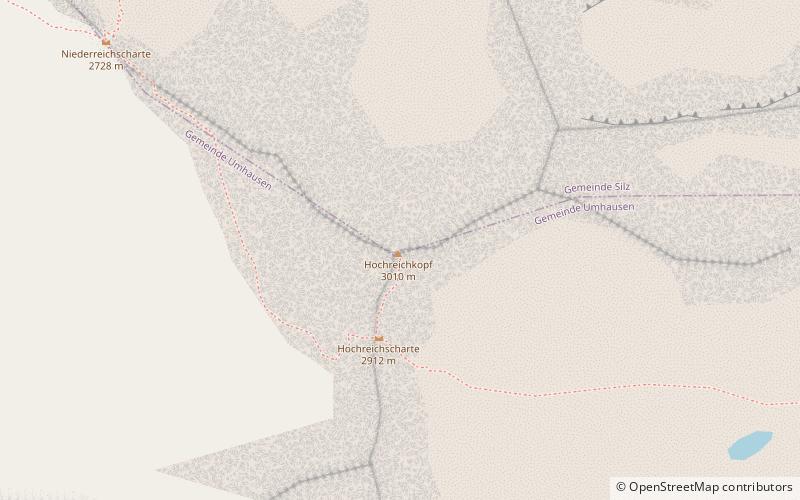
The Hochreichkopf is a mountain in the northwestern part of the Stubai Alps in the Austrian state of Tyrol. Its broad summit lies between the Niederreichjoch and Hochreichjoch cols east of and above the Ötztal valley. ()
TyrolAustria
Hochreichkopf plan & book
Unleash the traveler in you — discover the cheapest flight deals, find the perfect hotel or hostel nearby, and search for the best car rental prices. Travel at your own pace to discover new places and enjoy your journey.
Hochreichkopf – popular in the area (distance from the attraction)
Nearby attractions include: Sulzkogel, Pirchkogel, Acherkogel, Zwölferkogel.
2.1 miNENature, Natural attraction, MountainSulzkogel
54 min walk • Sulzkogel in Austria is a majestic peak that beckons mountain enthusiasts and nature lovers alike. Rising to an elevation of 3,016 meters, it is one of the accessible 3,000-meter summits in the Stubai Alps, offering panoramic views that capture the raw beauty of the...
4.5 miNNature, Natural attraction, MountainPirchkogel
116 min walk • The Pirchkogel is a mountain, 2,828 m, in the Stubai Alps in Tyrol. It is a good viewing mountain.
1.4 miNWNature, Natural attraction, MountainAcherkogel
37 min walk • The Acherkogel is a mountain in the Austrian Alps with a 3,008 m above sea level high summit. It is the northernmost three-thousander in the state of Tyrol.
2.4 miNENature, Natural attraction, MountainZwölferkogel
61 min walk • The Zwölferkogel is a mountain, 2,988 m, in the Stubai Alps in the Austrian state of Tyrol.
6.7 miNENature, Natural attraction, MountainRietzer Grießkogel
171 min walk • The Rietzer Grießkogel is a mountain, 2,884 m, and the highest peak in the Northern Sellrain Mountains, part of the Stubai Alps in the Austrian state of Tyrol. The summit is easily climbed on path no. 153. The first documented ascent was undertaken in 1829 by Innsbruck botanist, Andrä Sauter, a brother of Anton Sauter.
7.1 miSENature, Natural attraction, MountainHoher Seeblaskogel
183 min walk • The Hoher Seeblaskogel is a mountain, 3,235 m, in the western part of the Stubai Alps in the Austrian state of Tyrol. Its independent summit lies between the cols of Winnebachjoch and Bachfallenscharte.
3.7 miENature, Natural attraction, MountainZwieselbacher Rosskogel
95 min walk • The Zwieselbacher Rosskogel is a double peak in the northern Stubai Alps in the Austrian state of Tyrol. Its summit offers a sweeping panorama to the north because no other higher mountains impede the view.
6.2 miSWNature, Natural attraction, MountainFundusfeiler
157 min walk • The Fundusfeiler is a mountain in the Geigenkamm group of the Ötztal Alps.
3.1 miSWNature, Natural attraction, ValleyÖtztal, Umhausen
79 min walk • The Ötztal is an alpine valley located in Tyrol, Austria. The Ötztaler Ache river flows through the valley in a northern direction. The Ötztal separates the Stubai Alps in the east from the Ötztal Alps in the west. The valley is 65 km long.
4.8 miSENature, Natural attraction, MountainStrahlkogel
124 min walk • The Strahlkogel, at 3,288 m, is the highest peak in the Larstiger Mountains, a subgroup of the Stubai Alps in the Austrian state of Tyrol. The Strahlkogel is also the highest mountain in the municipality of Umhausen.
5.9 miSENature, Natural attraction, MountainGleirscher Fernerkogel
151 min walk • The Gleirscher Fernerkogel, also Gleirschfernerkogl, formerly called the Roßkarspitze, is a mountain, 3,189 m, in the Southern Sellrain Mountains, a subgroup of the Stubai Alps. It rises in the Austrian state of Tyrol.