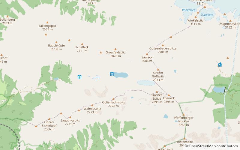
Dösener See
#159 among destinations in Austria

Facts and practical information
Dösener See is an alpine lake of Carinthia, Austria. It is part of the High Tauern National Park. ()
CarinthiaAustria
Dösener See plan & book
Unleash the traveler in you — discover the cheapest flight deals, find the perfect hotel or hostel nearby, and search for the best car rental prices. Travel at your own pace to discover new places and enjoy your journey.
Dösener See – popular in the area (distance from the attraction)
Nearby attractions include: Stappitzer See, Hochalmspitze, Ankogel, Falkenstein Castle.
 Nature, Natural attraction, Lake
Stappitzer See
107 min walk • Nestled amidst the breathtaking scenery of the Hohe Tauern National Park in Austria, Stappitzer See is a serene alpine lake that offers visitors a tranquil escape into nature. Known for its crystal-clear waters and the stunning mountain backdrop, this picturesque lake...
 Nature, Natural attraction, Mountain
Hochalmspitze
75 min walk • The Hochalmspitze is located east of Mallnitz in the Austrian state of Carinthia. It is sometimes called "Tauern Queen" as a counterpart to the "Tauern King", the Grossglockner.
 Nature, Natural attraction, Mountain
Ankogel
114 min walk • The Ankogel is a mountain in the Ankogel Group in the eastern High Tauern range in Austria. It is the second highest mountain in the group, the Hochalmspitze being higher at 3,360 m.
 Forts and castles
Falkenstein Castle
123 min walk • Niederfalkenstein Castle is a medieval castle near Obervellach in Carinthia, Austria. It is part of the larger Falkenstein fortification complex; while the main fortress of Oberfalkenstein today is a ruin, the lower barbican of Niederfalkenstein is largely preserved.
 Nature, Natural attraction, Mountain
Reißeck Mountain
133 min walk • The Reißeck, also Großes Reißeck is, at 2,965 metres above the Adriatic, the highest peak of the Reißeck Group in the High Tauern of Carinthia, Austria. The range forms the southern part of the larger Ankogel Group with its highest summit, the Hochalmspitze, separated by the col of Mallnitzer Scharte at 2,673 m.
 Forts and castles
Burgruine Groppenstein
136 min walk • Burgruine Groppenstein is a castle in Carinthia, Austria.
 Nature, Natural attraction, Mountain
Ankogel Group
77 min walk • The Ankogel Group is a sub-group of the Central Eastern Alps. Together with the Goldberg Group, the Glockner Group, the Schober Group, the Kreuzeck Group, the Granatspitze Group, the Venediger Group, the Villgraten Mountains and the Rieserferner Group it forms the mountain range of the Hohe Tauern.
 Forts and castles
Burgruine Falkenstein
123 min walk • Falkenstein Castle is a ruined medieval castle near Obervellach in Carinthia, Austria. It was built in the 12th century as part of a larger fortification complex comprising the preserved advanced work of Niederfalkenstein below.
 Forts and castles
Schloss Trabuschgen
127 min walk • Trabuschgen Castle on the northern edge of Obervellach is privately owned. The name Trabuschgen goes back to a Slavic term for a bulbous elevation of land.
 Nature, Natural attraction, Mountain
Säuleck
24 min walk • Säuleck - a peak in the Ankogelgruppe group, in high tauri in the Eastern Alps. It lies in Austria in the union country of Carinthia. It is adjacent to Hochalmspitze, with which it is connected by a long ridge.
 Tunnel
Tauern Railway Tunnel, Mallnitz
163 min walk • The Tauern Railway Tunnel in Austria is the longest tunnel of the Tauern Railway crossing the main chain of the Alps. Currently, it has a length of 8.371 kilometres. The highest point of the tunnel, which is also the highest point in all of the railway line, is at 1,226 metres above sea level.


