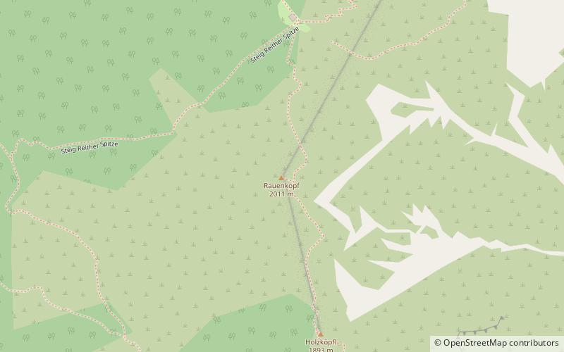
Rauenkopf
#659 among destinations in Austria

Facts and practical information
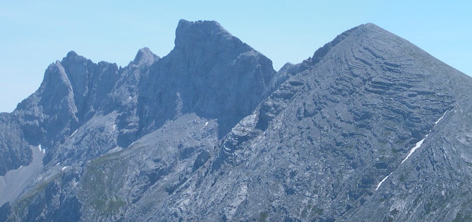
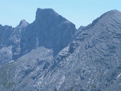
The Rauenkopf, also Rauchenkopf, is a mountain northeast of Reith bei Seefeld in the Karwendel Alps in the Austrian state of Tyrol. It is 2,011 metres high. ()
TyrolAustria
Rauenkopf plan & book
Unleash the traveler in you — discover the cheapest flight deals, find the perfect hotel or hostel nearby, and search for the best car rental prices. Travel at your own pace to discover new places and enjoy your journey.
Rauenkopf – popular in the area (distance from the attraction)
Nearby attractions include: Solsteinhaus, Toni-Seelos-Olympiaschanze, Wildsee, Nördlinger Hut.
 Alpine hut, Hiking
Solsteinhaus
72 min walk • Nestled in the heart of the Austrian Alps, the Solsteinhaus serves as a beacon of refuge and hospitality for mountaineers and nature enthusiasts alike. This alpine hut, perched at an elevation of 1,805 meters, provides a scenic backdrop for visitors seeking to explore...
 Sport venue, Sport
Toni-Seelos-Olympiaschanze, Seefeld in Tirol
65 min walk • Toni-Seelos-Olympiaschanze is a ski jumping hill in Seefeld outside of Innsbruck, Austria. It is a part of the Seefeld Nordic Competence Centre consists of two hills, a normal hill with a hill size of HS109 and medium hill with at HS75.
 Nature, Natural attraction, Lake
Wildsee, Seefeld in Tirol
51 min walk • The Wildsee, occasionally also called the Seefelder See, is a lake near the Austrian resort of Seefeld in Tirol at the foot of the Gschwandtkopf. It has an area of 6.1 hectares and a maximum depth of 5.1 metres.
 Alpine hut, Hiking
Nördlinger Hut
23 min walk • Nestled in the rugged heart of the Austrian Alps, the Nördlinger Hut is an alpine refuge that offers a serene escape amidst the towering peaks. This alpine hut, situated at an elevation of 2,239 meters, is a popular destination for mountaineers and hikers seeking...
 Nature, Natural attraction, Mountain
Reither Spitze
28 min walk • Reither Spitze is an awe-inspiring peak located in the heart of the Austrian Alps. Rising to an elevation of 2,374 meters, this mountain is a popular destination for climbers and hikers seeking the thrill of conquering its slopes and the reward of breathtaking views.
 Church
Zirl Parish Church, Zirl
68 min walk • The Zirl Parish Church, also known as the Holy Cross Parish Church, is the largest place of worship in Zirl, a community in Tyrol, Austria. Built in the 19th century under the auspices of Cons. Peter Alois Bauer and Fruehmesser Alois Moriggl, the painter Franz Plattner decorated the entire interior with frescoes in vivid colours.
 Nature, Natural attraction, Lake
Wildmoossee
109 min walk • The Wildmoossee is an aperiodic mountain lake, 3 kilometres west of Seefeld in Tirol near the village of Wildmoos in the market borough of Telfs. The lake lies in the area of the water-soluble main dolomite of the Seefeld Plateau at a height of 1,316 metres.
 Nature, Natural attraction, Mountain
Seefelder Spitze, Seefeld in Tirol
44 min walk • The Seefelder Spitze is a mountain east of Seefeld in Tirol in the Karwendel Alps in the Austrian state of Tyrol. It is 2,221 metres high and there is a summit cross at the top.
 Nature, Natural attraction, Mountain
Erlspitze
71 min walk • The Erlspitze, at 2,405 m, is the highest mountain of the range to which it gives its name in the southeastern corner of the Karwendel Alps.
 Nature, Natural attraction, Mountain
Kleiner Solstein, Innsbruck
116 min walk • The Kleiner Solstein is a mountain, 2,637 m high, in the Nordkette in the Karwendel Alps in the Austrian state of Tyrol. Despite its name it towers above its western neighbour, the Großer Solstein by almost 100 m and is thus the highest summit in the Nordkette.
 Nature, Natural attraction, Mountain
Zirler Berg
42 min walk • The Zirler Berg near Zirl in the Austrian federal state of Tyrol is a mountain, 1,057 m high, in the Karwendel Alps, a western part of the Northern Limestone Alps.