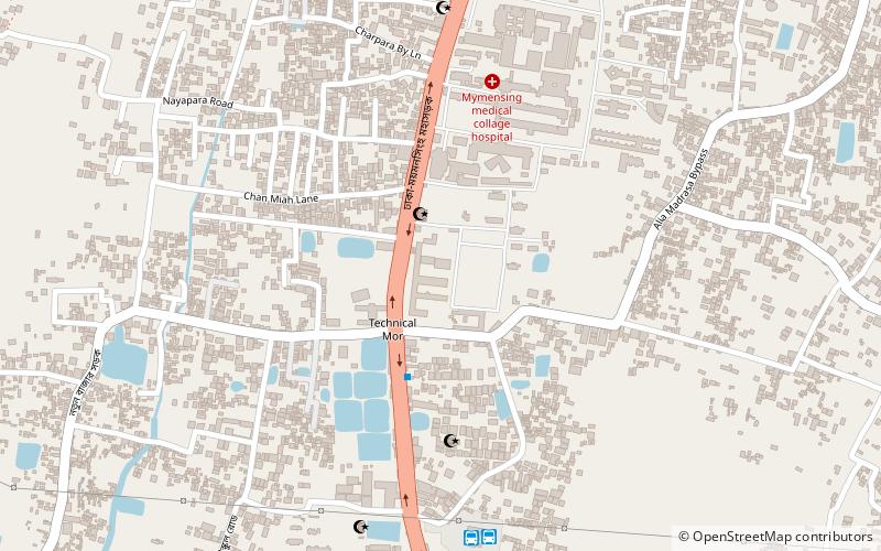
Mymensingh Cantonment, Mymensingh
Map
Facts and practical information
Mymensingh Cantonment was the headquarters of the 19th Infantry Division of the Bangladesh Army. Presently it has the headquarters of ARTDOC which consists of its Battle Group and all the training institutions. The 77th Infantry Brigade under 19th Infantry Division is located there. The first General Officer Commanding of ARTDOC was Major General Md Zia-Ur-Rahman. ()
Local name: ময়মনসিংহ সেনানিবাসCoordinates: 24°45'14"N, 90°24'11"E
Address
Mymensingh
ContactAdd
Social media
Add
Getting there by public transportation
Public transportation stops near this location
- Bus
- Train
 Bus
Bus
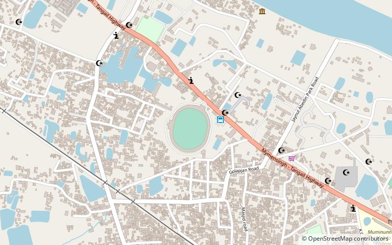
- Calculate routeTrishal Bus Stand ত্রিশাল বাস স্ট্যান্ড 4 min walk
- Calculate routetangail bus station 32 min walk
- Calculate routeUttar Bongo Bus Stand 32 min walk
- Calculate routeBus Stand 32 min walk
- Calculate routeMymensingh Railway Junction 12 min walk
Day trips


Frequently Asked Questions (FAQ)
Which popular attractions are close to Mymensingh Cantonment?
Nearby attractions include Mymensingh Museum, Mymensingh (13 min walk), Shahid Syed Nazrul Islam College, Mymensingh (15 min walk), Ananda Mohan College, Mymensingh (18 min walk), Muminunnesa Women's College, Mymensingh (18 min walk).
How to get to Mymensingh Cantonment by public transport?
The nearest stations to Mymensingh Cantonment:
Bus
Train
Bus
- Trishal Bus Stand ত্রিশাল বাস স্ট্যান্ড (4 min walk)
- tangail bus station (32 min walk)
Train
- Mymensingh Railway Junction (12 min walk)