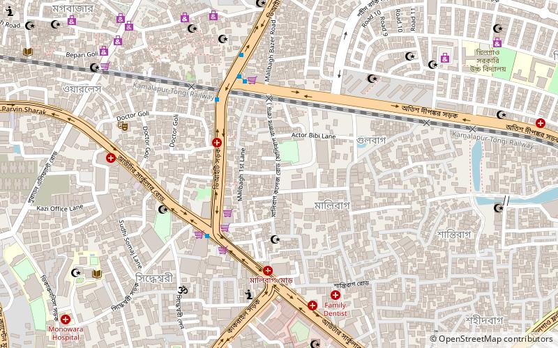
Malibagh, Dhaka
Map
Facts and practical information
Malibagh is the name of a neighborhood in Dhaka, the capital of Bangladesh. It is under Shahjahanpur Thana. The word 'mali' means gardener and the word 'bagh' means garden. Thus, the literal meaning of 'Malibagh' is gardener's garden or neighborhood. It is a densely populated area near Maghbazar. This area is occupied with many business shops, markets, offices, schools, and colleges. It is one of the busiest traffic spots of Dhaka City. ()
Coordinates: 23°44'50"N, 90°24'51"E
Address
মতিঝিল থানা (matijhila thana)Dhaka
ContactAdd
Social media
Add
Getting there by public transportation
Public transportation stops near this location
- Bus
- Train
 Bus
Bus
- Calculate routeGreenline Bus Terminal 12 min walk
- Calculate routeBRTCl Bus Terminal 32 min walk
- Calculate routeBRTC Kamalapur Bus Depot 33 min walk
- Calculate routeKamalapur Railway Station 36 min walk
Day trips


Frequently Asked Questions (FAQ)
Which popular attractions are close to Malibagh?
Nearby attractions include Jamia Shariyyah Malibagh, Dhaka (6 min walk), Shree Shree Siddheswari Kalimandir, Dhaka (8 min walk), Stamford University Bangladesh, Dhaka (11 min walk), Habibullah Bahar College, Dhaka (13 min walk).
How to get to Malibagh by public transport?
The nearest stations to Malibagh:
Bus
Train
Bus
- Greenline Bus Terminal (12 min walk)
- BRTCl Bus Terminal (32 min walk)
Train
- Kamalapur Railway Station (36 min walk)