Rue de la Loi, Saint-Josse-ten-Noode
Map

Gallery

Facts and practical information
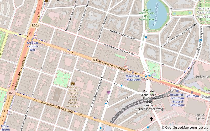
The Rue de la Loi or Wetstraat, meaning "Law Street", is a major street running through central and eastern Brussels, Belgium, which is famous due to the presence of several notable Belgian and EU governmental buildings. The road runs from the Rue Royale/Koningsstraat, in central Brussels, to the Schuman roundabout in its European Quarter. It forms the first part of the N3 road that runs to Aachen, Germany. ()
Address
Bruxelles-Ville (Quartier Europeen)Saint-Josse-ten-Noode
ContactAdd
Social media
Add
Day trips
Rue de la Loi – popular in the area (distance from the attraction)
Nearby attractions include: Jazz Station, Bortier Gallery, House of European History, Leopold Park.
Frequently Asked Questions (FAQ)
Which popular attractions are close to Rue de la Loi?
Nearby attractions include Concert Noble, Brussels (4 min walk), Jardin du Maelbeek, Brussels (5 min walk), Square Frère-Orban - Frère-Orbansquare, Brussels (5 min walk), Saint Joseph's Church, Brussels (6 min walk).
How to get to Rue de la Loi by public transport?
The nearest stations to Rue de la Loi:
Bus
Metro
Train
Tram
Ferry
Bus
- Toulouse • Lines: 21, 27, 543, 64 (3 min walk)
- Maelbeek - Maalbeek • Lines: 59, 64 (4 min walk)
Metro
- Maelbeek - Maalbeek • Lines: 1, 5 (3 min walk)
- Arts-Loi - Kunst-Wet • Lines: 1, 2, 5, 6 (7 min walk)
Train
- Brussels-Schuman (7 min walk)
- Brussels-Luxembourg (11 min walk)
Tram
- Parc - Park • Lines: 92, 93 (15 min walk)
- Palais - Paleizen • Lines: 92, 93 (16 min walk)
Ferry
- Quai des Péniches - Akenkaai • Lines: Wb (42 min walk)


