State Museum, Goiânia
Map
Facts and practical information
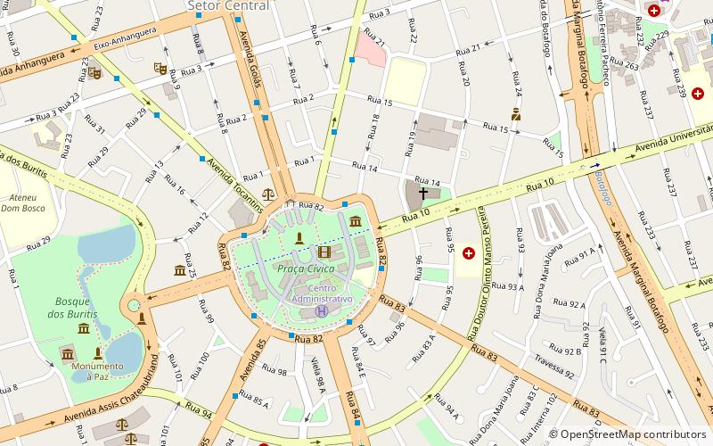
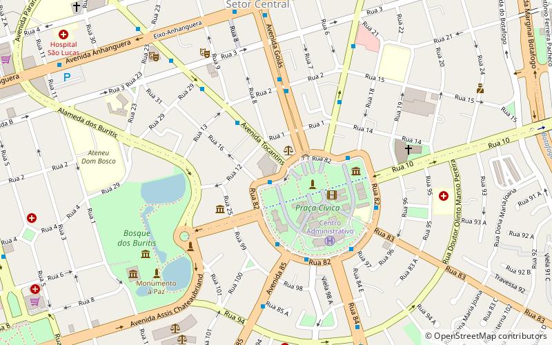
State Museum (address: Praça Dr. Pedro Ludovico Teixeira, 13) is a place located in Goiânia (Goiás state) and belongs to the category of museum.
It is situated at an altitude of 2533 feet, and its geographical coordinates are 16°40'48"S latitude and 49°15'18"W longitude.
Planning a visit to this place, one can easily and conveniently get there by public transportation. State Museum is a short distance from the following public transport stations: Rua 20 (bus, 14 min walk).
Among other places and attractions worth visiting in the area are: Praça Cívica (park, 3 min walk), Catedral Metropolitana de Goiânia (church, 3 min walk), Palácio das Esmeraldas (palace, 4 min walk).
Coordinates: 16°40'48"S, 49°15'18"W
Address
Praça Dr. Pedro Ludovico Teixeira, 13Goiânia 74083-010
Contact
+55 62 3201-4675
Social media
Add
Getting there by public transportation
Public transportation stops near this location
- Bus
 Bus
Bus
- Calculate routeRua 20 14 min walk
- Calculate routeJockey Club 17 min walk
- Calculate routeHgg 25 min walk
- Calculate routeUniversitária 26 min walk
Day trips


Frequently Asked Questions (FAQ)
When is State Museum open?
State Museum is open:
- Monday closed
- Tuesday 9 am - 5 pm
- Wednesday 9 am - 5 pm
- Thursday 9 am - 5 pm
- Friday 9 am - 5 pm
- Saturday 9 am - 3 pm
- Sunday 9 am - 3 pm
Which popular attractions are close to State Museum?
Nearby attractions include Praça Cívica, Goiânia (3 min walk), Catedral Metropolitana de Goiânia, Goiânia (3 min walk), Palácio das Esmeraldas, Goiânia (4 min walk), Instituto Histórico e Geográfico de Goiás - IHGG, Goiânia (6 min walk).
How to get to State Museum by public transport?
The nearest stations to State Museum:
Bus
Bus
- Rua 20 (14 min walk)
- Jockey Club (17 min walk)