Dunbar Street, Vancouver
Map
Facts and practical information
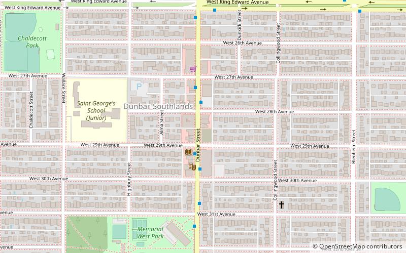
Dunbar Street is a road in Vancouver, British Columbia, Canada. The street runs through the Dunbar–Southlands neighbourhood from 51st Avenue and the Point Grey Golf and Country Club in the south and continues to the north as Alma Street, via the Dunbar Diversion. The built-up commercial area along Dunbar Street is surrounded predominantly by single-family properties – the only such commercial strip in Vancouver. Separately, Dunbar Street runs through West Point Grey as a narrow residential road, from 13th Avenue to Point Grey Road. ()
Coordinates: 49°14'48"N, 123°11'6"W
Address
DunbarVancouver
ContactAdd
Social media
Add
Getting there by public transportation
Public transportation stops near this location
- Bus
- Trolleybus
 Bus
Bus
- Calculate routeDunbar St at West 28th Ave 2 min walk
- Calculate routeWest King Edward Ave at Dunbar St 6 min walk
- Calculate routeDunbar St at West 22nd Ave 12 min walk
Maps SkyTrain
SkyTrainDay trips


Frequently Asked Questions (FAQ)
Which popular attractions are close to Dunbar Street?
Nearby attractions include Dunbar–Southlands, Vancouver (6 min walk), Arbutus Ridge, Vancouver (23 min walk).
How to get to Dunbar Street by public transport?
The nearest stations to Dunbar Street:
Trolleybus
Bus
Trolleybus
- Dunbar St at West 28th Ave • Lines: 7 (2 min walk)
Bus
- West King Edward Ave at Dunbar St • Lines: 25 (6 min walk)
- Dunbar St at West 22nd Ave • Lines: 25 (12 min walk)