Hycroft Gallery, Vancouver
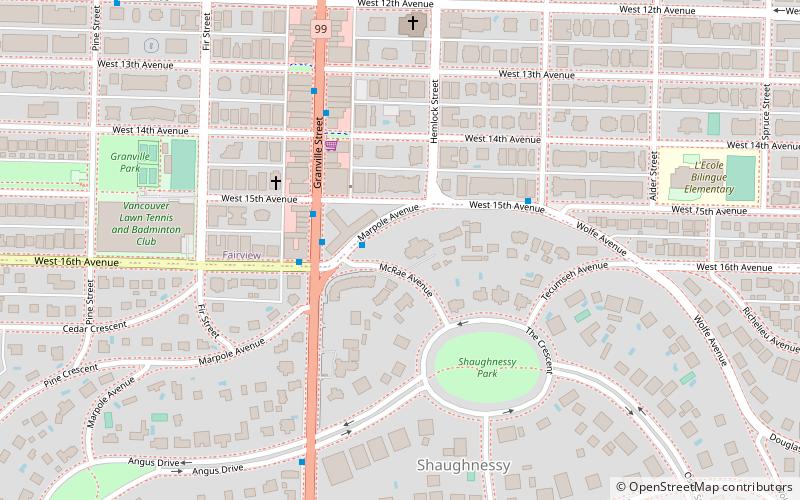
Map
Facts and practical information
The following is a list of buildings and structures classified as Schedule "A" and Schedule "B" heritage buildings by the City of Vancouver, British Columbia, Canada. These are designated heritage buildings, and as such are legally protected by the city's heritage by-law No. 4837. ()
Coordinates: 49°15'26"N, 123°8'13"W
Getting there by public transportation
Public transportation stops near this location
- Metro
- Bus
- Trolleybus
- Ferry
 Metro
Metro
- Calculate routeMarpole Avenue at McRae Avenue 1 min walk
- Calculate routeGranville St at West 15th Ave 3 min walk
- Calculate routeWest 16th Avenue at Granville Street 3 min walk
- Calculate routeWest 15th Avenue at Birch Street 4 min walk
- Calculate routeGranville St at West 16th Ave 2 min walk
- Calculate routeDavid Lam Park Terminal 27 min walk
- Calculate routeGranville Island Terminal 27 min walk
- Calculate routeGranville Island Dock 29 min walk
- Calculate routeStamps Landing Dock 30 min walk
- Calculate routeBroadway-City Hall 28 min walk
- Calculate routeKing Edward 29 min walk
- Calculate routeOlympic Village 30 min walk
- Calculate routeYaletown-Roundhouse 35 min walk
Maps SkyTrain
SkyTrainDay trips


Frequently Asked Questions (FAQ)
Which popular attractions are close to Hycroft Gallery?
Nearby attractions include Main Street, Vancouver (12 min walk), Canadian Memorial United Church and Centre For Peace, Vancouver (12 min walk), Congregation Schara Tzedeck, Vancouver (13 min walk), Douglas Reynolds Gallery, Vancouver (14 min walk).
How to get to Hycroft Gallery by public transport?
The nearest stations to Hycroft Gallery:
Bus
Trolleybus
Ferry
Metro
Bus
- Marpole Avenue at McRae Avenue • Lines: 33 (1 min walk)
- Granville St at West 15th Ave • Lines: N10 (3 min walk)
Trolleybus
- Granville St at West 16th Ave • Lines: 10 (2 min walk)
Ferry
- David Lam Park Terminal • Lines: Aquabus, False Creek Ferries Route 3 (27 min walk)
- Granville Island Terminal • Lines: Aquabus (27 min walk)
Metro
- Broadway-City Hall • Lines: Canada Line (28 min walk)
- King Edward • Lines: Canada Line (29 min walk)