Charleson Park, Vancouver
Gallery (1)
Map
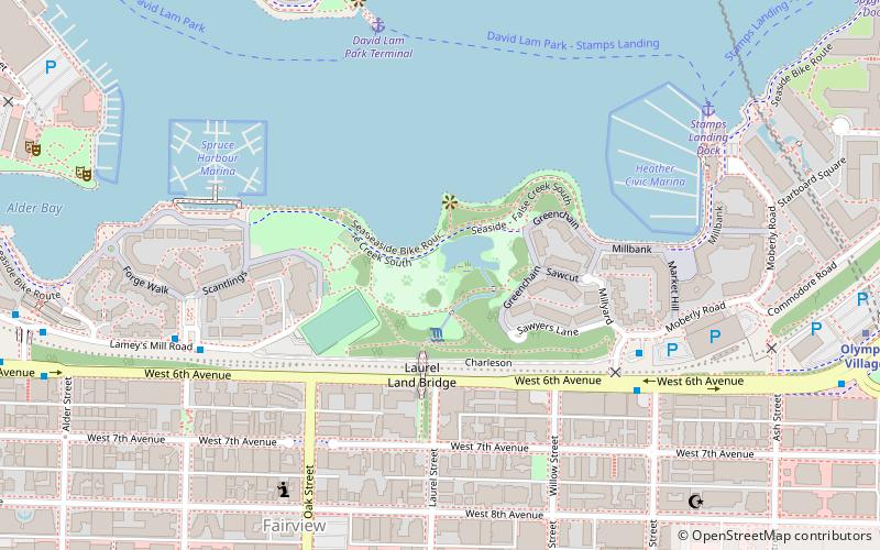
Map
Facts and practical information
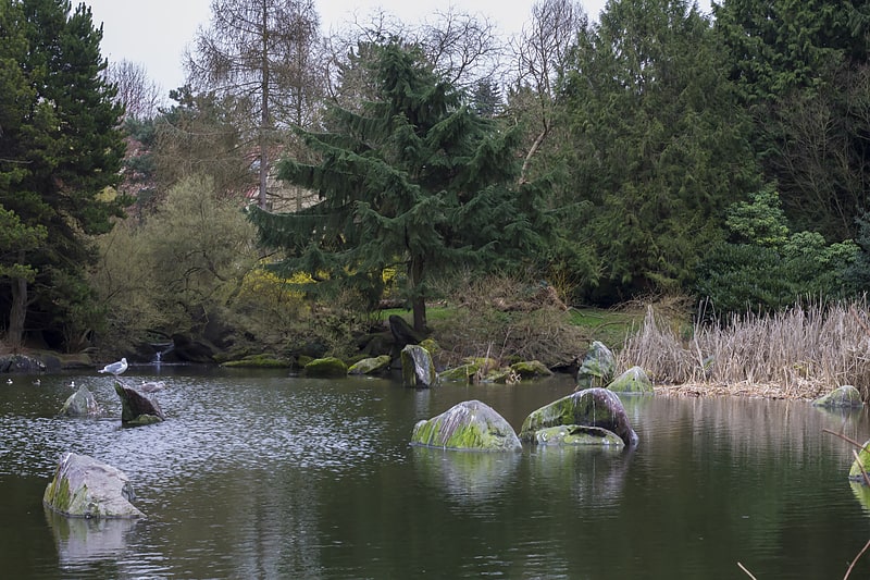
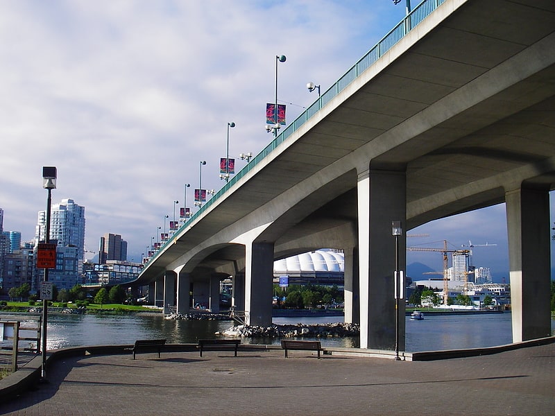
Charleson Park is a 7.14-hectare park along False Creek, located in the Fairview neighborhood of Vancouver, British Columbia, Canada. It has skyline views of the city. ()
Elevation: 23 ft a.s.l.Coordinates: 49°16'2"N, 123°7'26"W
Getting there by public transportation
Public transportation stops near this location
- Metro
- Bus
- Trolleybus
- Train
- Ferry
 Metro
Metro
- Calculate routeHeather Square Bay 2 5 min walk
- Calculate routeWest 6th Ave at Moberly Rd 6 min walk
- Calculate routeLamey's Mill Road at Sitka Square 6 min walk
- Calculate routeDavid Lam Park Terminal 6 min walk
- Calculate routeStamps Landing Dock 8 min walk
- Calculate routeYaletown Dock 11 min walk
- Calculate routeSpyglass Dock 12 min walk
- Calculate routeWest Broadway at Laurel Street 8 min walk
- Calculate routeWest Broadway at Willow Street 8 min walk
- Calculate routeOlympic Village 10 min walk
- Calculate routeYaletown–Roundhouse 13 min walk
- Calculate routeBroadway-City Hall 14 min walk
- Calculate routeVancouver Pacific Central 33 min walk
Maps SkyTrain
SkyTrainDay trips


Frequently Asked Questions (FAQ)
Which popular attractions are close to Charleson Park?
Nearby attractions include False Creek, Vancouver (4 min walk), Pelican Bay Marina, Vancouver (8 min walk), George Wainborn Park, Vancouver (11 min walk), Gallery of BC Ceramics, Vancouver (13 min walk).
How to get to Charleson Park by public transport?
The nearest stations to Charleson Park:
Bus
Ferry
Trolleybus
Metro
Train
Bus
- Heather Square Bay 2 • Lines: 50 (5 min walk)
- West 6th Ave at Moberly Rd • Lines: 84 (6 min walk)
Ferry
- David Lam Park Terminal • Lines: Aquabus, False Creek Ferries Route 3 (6 min walk)
- Stamps Landing Dock • Lines: Aquabus, False Creek Ferries Route 3 (8 min walk)
Trolleybus
- West Broadway at Laurel Street • Lines: 17, 9 (8 min walk)
- West Broadway at Willow Street • Lines: 9 (8 min walk)
Metro
- Olympic Village • Lines: Canada Line (10 min walk)
- Yaletown–Roundhouse • Lines: Canada Line (13 min walk)
Train
- Vancouver Pacific Central (33 min walk)