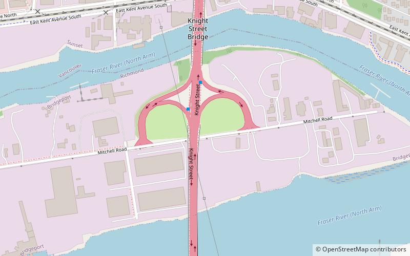
Knight Street Bridge, Richmond

Gallery (1)
Map
Map
Facts and practical information
The Knight Street Bridge is a crossing over the north arm of the Fraser River, the Canadian National Railway line, and several roads, in Metro Vancouver. ()
Length: 4711 ftCoordinates: 49°12'20"N, 123°4'37"W
Address
Mitchell IslandRichmond
ContactAdd
Social media
Add
Getting there by public transportation
Public transportation stops near this location
- Bus
- Trolleybus
 Bus
Bus
- Calculate routeKnight St at Mitchell Rd 2 min walk
- Calculate routeKnight St Bridge Offramp at Southeast Marine Dr 10 min walk
- Calculate routeSoutheast Marine Dr at Knight St 10 min walk
- Calculate routeKnight St Underpass at Southeast Marine Dr 10 min walk
- Calculate routeHarrison Dr at Victoria Dr 16 min walk
- Calculate routeVictoria Dr at Thornhill Dr 19 min walk
Day trips


Frequently Asked Questions (FAQ)
How to get to Knight Street Bridge by public transport?
The nearest stations to Knight Street Bridge:
Bus
Trolleybus
Bus
- Knight St at Mitchell Rd • Lines: 405, 407, 430 (2 min walk)
- Knight St Bridge Offramp at Southeast Marine Dr • Lines: 405, 407 (10 min walk)
Trolleybus
- Harrison Dr at Victoria Dr • Lines: 20 (16 min walk)
- Victoria Dr at Thornhill Dr • Lines: 20 (19 min walk)