Canadian Northern Ontario Railway Federal Bridge, Ottawa

Gallery (1)
Map
Map
Facts and practical information
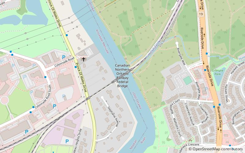
The Canadian Northern Ontario Railway Bridge is a railway plate girder bridge over the Rideau River from the Merivale area to the Mooney's Bay neighbourhood in Ottawa, Ontario, Canada. It is owned today by the CNoR's successor Canadian National Railway, and amongst other services carries the Via Rail Toronto – Ottawa Corridor passenger trains. ()
Opened: 3 December 1913 (112 years ago)Coordinates: 45°20'44"N, 75°41'52"W
Address
Ottawa
ContactAdd
Social media
Add
Getting there by public transportation
Public transportation stops near this location
- Bus
 Bus
Bus
- Calculate routeColonnade / AD. 112 7 min walk
- Calculate routeRiverside / Rivergate 8 min walk
Day trips


Frequently Asked Questions (FAQ)
How to get to Canadian Northern Ontario Railway Federal Bridge by public transport?
The nearest stations to Canadian Northern Ontario Railway Federal Bridge:
Bus
Bus
- Colonnade / AD. 112 • Lines: 89 (7 min walk)
- Riverside / Rivergate • Lines: 90 (8 min walk)