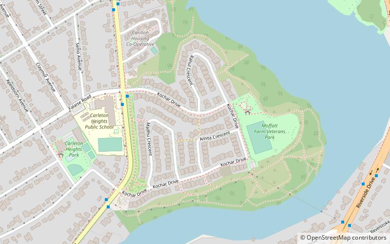
Prince of Wales on the Rideau, Ottawa
Map
Facts and practical information
Coordinates: 45°21'37"N, 75°41'49"W
Address
Carleton HeightsOttawa
ContactAdd
Social media
Add
Getting there by public transportation
Public transportation stops near this location
- Bus
 Bus
Bus
- Calculate routeRiverside / AD. 3200 10 min walk
Day trips


Frequently Asked Questions (FAQ)
Which popular attractions are close to Prince of Wales on the Rideau?
Nearby attractions include Rideau View, Ottawa (13 min walk), Carleton Heights, Ottawa (16 min walk), Mooney's Bay Park, Ottawa (16 min walk), St. Elias Antiochian Orthodox Cathedral, Ottawa (17 min walk).
How to get to Prince of Wales on the Rideau by public transport?
The nearest stations to Prince of Wales on the Rideau:
Bus
Bus
- Riverside / AD. 3200 • Lines: 90 (10 min walk)