Moray Bridge, Richmond

Gallery (3)
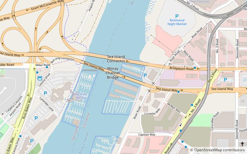
Map
Map
Gallery
Facts and practical information
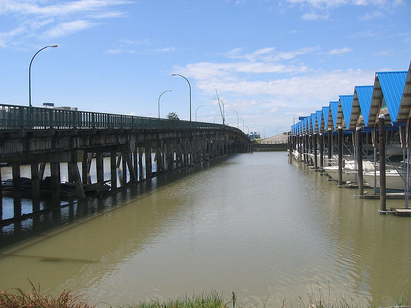
The Moray Bridge, a.k.a the Moray Channel Bridge, and formerly the Middle Arm Bridge, is a crossing over the middle arm of the Fraser River in Metro Vancouver. Richard Moody, who would name geographical features, such as this channel, after acquaintances, honoured Jonathan Moray, a sergeant in the Corps of Royal Engineers, and later the New Westminster police chief. ()
Opened: 1957 (69 years ago)Coordinates: 49°11'30"N, 123°8'10"W
Address
Richmond City Centre (Golden Village)Richmond
ContactAdd
Social media
Add
Getting there by public transportation
Public transportation stops near this location
- Metro
- Bus
- Trolleybus
 Metro
Metro
- Calculate routeBridgeport Rd at West Rd 6 min walk
- Calculate routeMiller Rd at Russ Baker Way 7 min walk
- Calculate routeAirport Station 7 min walk
- Calculate routeNo. 3 Rd at Capstan Way 7 min walk
- Calculate routeBridgeport 14 min walk
- Calculate routeAberdeen 14 min walk
- Calculate routeTempleton 15 min walk
- Calculate routeSea Island Centre 26 min walk
- Calculate routeSW Marine Dr at Hudson St 21 min walk
- Calculate routeMarpole Loop Bay 4 22 min walk
Day trips


Frequently Asked Questions (FAQ)
Which popular attractions are close to Moray Bridge?
Nearby attractions include Sea Island Connector, Richmond (2 min walk), Middle Arm Bridge, Richmond (8 min walk), Arthur Laing Bridge, Richmond (12 min walk), Burkeville, Richmond (13 min walk).
How to get to Moray Bridge by public transport?
The nearest stations to Moray Bridge:
Bus
Metro
Trolleybus
Bus
- Bridgeport Rd at West Rd • Lines: 412 (6 min walk)
- Miller Rd at Russ Baker Way • Lines: 412, N10 (7 min walk)
Metro
- Bridgeport • Lines: Canada Line (14 min walk)
- Aberdeen • Lines: Canada Line (14 min walk)
Trolleybus
- SW Marine Dr at Hudson St • Lines: 10 (21 min walk)
- Marpole Loop Bay 4 • Lines: 10 (22 min walk)