Queenswood Heights, Ottawa
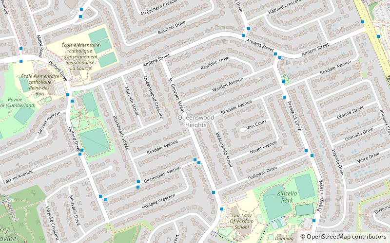
Map
Facts and practical information
Queenswood Heights is a neighbourhood located in Orleans, the suburb in the east end of Ottawa, Ontario, Canada. Prior to amalgamation in 2001, the neighbourhood was in the Township of Cumberland. Queenswood Heights is bounded by St. Joseph Boulevard to the north, Tenth Line Road to the east, Innes Road to the south, and the former Cumberland-Gloucester boundary to the west. According to the Canada 2016 Census, the population of the neighbourhood was 11,031. Queenswood Heights spans 3.71 square kilometres. ()
Coordinates: 45°28'15"N, 75°30'11"W
Address
Queenswood HeightsOttawa
ContactAdd
Social media
Add
Day trips
Queenswood Heights – popular in the area (distance from the attraction)
Nearby attractions include: Place d'Orléans, Vintage Wings of Canada, Petrie Island Beach, Pine View Golf Course.
Frequently Asked Questions (FAQ)
How to get to Queenswood Heights by public transport?
The nearest stations to Queenswood Heights:
Bus
Bus
- Gleneagles / St Georges • Lines: 234, 37 (3 min walk)
- St Georges / Galloway • Lines: 234, 37 (5 min walk)


