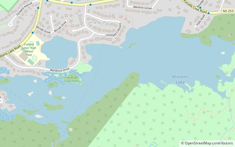
Williams Lake, Halifax
Map
Facts and practical information
Williams Lake, Halifax is a lake of the Halifax Regional Municipality, in Spryfield, Nova Scotia, Canada. ()
Elevation: 62 ft a.s.l.Coordinates: 44°37'11"N, 63°35'46"W
Address
ArmdaleHalifax
ContactAdd
Social media
Add
Getting there by public transportation
Public transportation stops near this location
- Bus
 Bus
Bus
- Calculate route6208 - Beaufort Ave Before Inglis St 22 min walk
- Calculate route6207 - Beaufort Ave After Inglis St 23 min walk
- Calculate route6210 - Beaufort Ave Before Oakland Rd 24 min walk
- Calculate route6209 - Beaufort Ave Before Oakland Rd 24 min walk
Day trips


Frequently Asked Questions (FAQ)
Which popular attractions are close to Williams Lake?
Nearby attractions include Williams Lake, Halifax (2 min walk), Sir Sandford Fleming Park, Halifax (19 min walk), Royal Nova Scotia Yacht Squadron, Halifax (20 min walk), Mainland Halifax, Halifax (21 min walk).
How to get to Williams Lake by public transport?
The nearest stations to Williams Lake:
Bus
Bus
- 6208 - Beaufort Ave Before Inglis St • Lines: 10 (22 min walk)
- 6207 - Beaufort Ave After Inglis St • Lines: 10 (23 min walk)