Honeydale Mall, Toronto

Gallery (1)
Map
Map
Facts and practical information
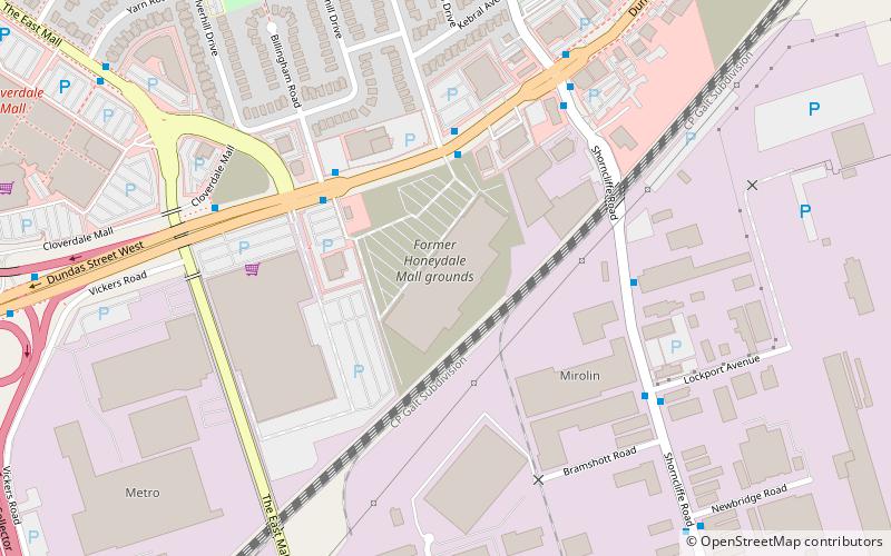
Honeydale Mall was a community shopping mall located in Eatonville, Toronto, Ontario, Canada, at the intersection of Dundas Street and The East Mall Crescent. ()
Coordinates: 43°37'45"N, 79°32'48"W
Getting there by public transportation
Public transportation stops near this location
- Metro
- Bus
- Train
 Metro
Metro
- Calculate routePaulart Drive 4 min walk
- Calculate routeEast Mall Crescent 4 min walk
- Calculate routeShaver Avenue South 7 min walk
- Calculate routeWilmar Road 13 min walk
- Calculate routeKipling 17 min walk
- Calculate routeKipling 20 min walk
- Calculate routeIslington 40 min walk
Maps SubwayMaps
 Streetcar systemMaps
 PATH
PATH
SubwayMapsStreetcar systemMapsPATHDay trips


Frequently Asked Questions (FAQ)
How to get to Honeydale Mall by public transport?
The nearest stations to Honeydale Mall:
Bus
Train
Metro
Bus
- Paulart Drive • Lines: 1 (4 min walk)
- East Mall Crescent • Lines: 1, 109, 900, 927B (4 min walk)
Train
- Kipling (17 min walk)
Metro
- Kipling • Lines: 2 (20 min walk)
- Islington • Lines: 2 (40 min walk)