Portobello West, Vancouver
Map
Facts and practical information
Portobello West fashion and art market is a seasonal market held in Vancouver, BC, Canada. The Market is a regular event from March to December at which local designers and artisans can sell their creations directly to the public. It was established in August 2006 by Carlie Smith, a graduate of Royal Roads University who, after living in London, England for two years, wanted to bring the European style market atmosphere to her home town. Carlie envisioned a regular event that would raise the profile of local designers and artisans as well as be a regular community event. ()
Coordinates: 49°16'18"N, 123°6'19"W
Address
Mt. PleasantVancouver
ContactAdd
Social media
Add
Getting there by public transportation
Public transportation stops near this location
- Metro
- Bus
- Trolleybus
- Train
- Ferry
 Metro
Metro
- Calculate routeVillage Dock 2 min walk
- Calculate routePlaza of Nations Dock 7 min walk
- Calculate routeSpyglass Dock 12 min walk
- Calculate routeYaletown Dock 15 min walk
- Calculate routeWest 2nd Ave at Manitoba St 5 min walk
- Calculate routeEast 2nd Ave at Ontario St 5 min walk
- Calculate routeQuebec Street at Terminal Avenue 6 min walk
- Calculate routeMain Street at Switchmen Street 6 min walk
- Calculate routeMain Street-Science World 7 min walk
- Calculate routeStadium–Chinatown 15 min walk
- Calculate routeOlympic Village 15 min walk
- Calculate routeBroadway-City Hall 19 min walk
- Calculate routeVancouver Pacific Central 10 min walk
- Calculate routeVancouver 23 min walk
- Calculate routeWaterfront 26 min walk
Maps SkyTrain
SkyTrainDay trips


Frequently Asked Questions (FAQ)
Which popular attractions are close to Portobello West?
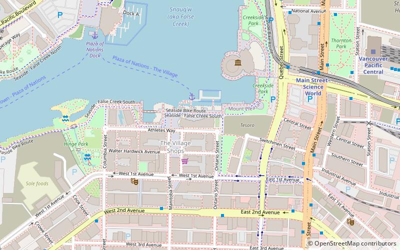
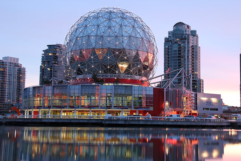
Nearby attractions include Science World, Vancouver (4 min walk), Hinge Park, Vancouver (6 min walk), Plaza of Nations, Vancouver (8 min walk), Georgia Viaduct, Vancouver (10 min walk).
How to get to Portobello West by public transport?
The nearest stations to Portobello West:
Ferry
Bus
Trolleybus
Metro
Train
Ferry
- Village Dock • Lines: Aquabus, False Creek Ferries Route 3 (2 min walk)
- Plaza of Nations Dock • Lines: Aquabus, False Creek Ferries Route 3 (7 min walk)
Bus
- West 2nd Ave at Manitoba St • Lines: 84 (5 min walk)
- East 2nd Ave at Ontario St • Lines: 84 (5 min walk)
Trolleybus
- Main Street at Switchmen Street • Lines: 19, 3, 8 (6 min walk)
Metro
- Main Street-Science World • Lines: Expo Line (7 min walk)
- Stadium–Chinatown • Lines: Expo Line (15 min walk)
Train
- Vancouver Pacific Central (10 min walk)
- Vancouver (23 min walk)