Palliser, Calgary
Map
Facts and practical information
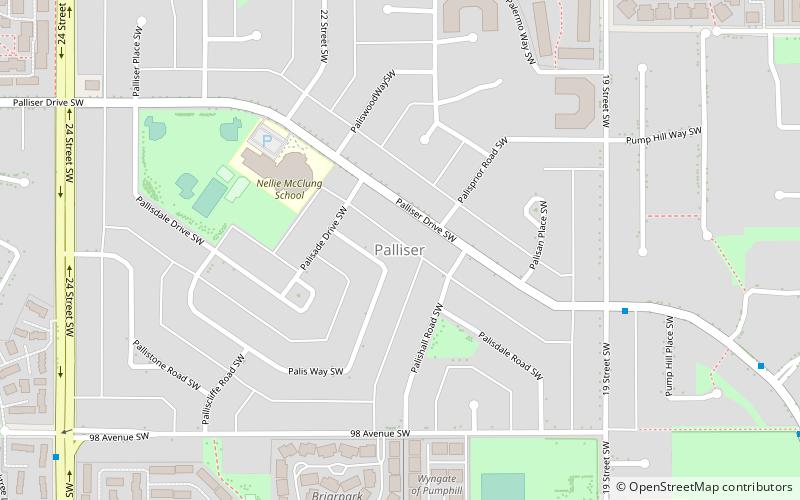
Palliser is a residential neighbourhood in the southwest quadrant of Calgary, Alberta. It is bounded to the north by 90 Ave SW, to the east by 19 Street SW, to the south by Southland Drive SW and to the west by 24 Street SW. The Tom Brook Athletic Park is located within the neighbourhood. ()
Area: 0.39 mi²Coordinates: 50°58'3"N, 114°6'39"W
Getting there by public transportation
Public transportation stops near this location
- Bus
- Train
 Bus
Bus
- Calculate route90 Avenue & 14 Street SW 19 min walk
- Calculate route90 Avenue SW 21 min walk
- Calculate routeHeritage Park 28 min walk
- Calculate routeHeritage Drive & Churchill Drive SW 30 min walk
- Calculate routeEncana 27 min walk
- Calculate routeDominion 30 min walk
Day trips


Frequently Asked Questions (FAQ)
How to get to Palliser by public transport?
The nearest stations to Palliser:
Bus
Train
Bus
- 90 Avenue & 14 Street SW • Lines: 79 (19 min walk)
- 90 Avenue SW • Lines: 304 (21 min walk)
Train
- Encana (27 min walk)
- Dominion (30 min walk)