Punjabi Market, Vancouver
Map
Facts and practical information
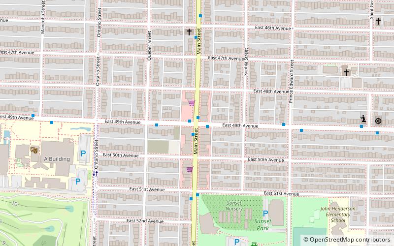
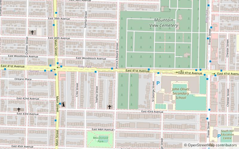
The Punjabi Market, also known as Little Punjab or Little India, is a commercial district and ethnic enclave in Vancouver, British Columbia. Officially recognized by the city as being primarily a major South Asian, Indo-Canadian and Punjabi population business community and cultural area, the Punjabi District is roughly a six block section of Main Street around 49th Avenue in the Sunset neighbourhood, named after its historically large Punjabi Sikh population. ()
Coordinates: 49°13'33"N, 123°6'6"W
Address
OakridgeVancouver
ContactAdd
Social media
Add
Getting there by public transportation
Public transportation stops near this location
- Metro
- Bus
- Trolleybus
 Metro
Metro
- Calculate routeEast 49th Avenue at Main Street 1 min walk
- Calculate routeWest 49th Avenue at Manitoba Street 8 min walk
- Calculate routeMain Street at East 49th Avenue 1 min walk
- Calculate routeLangara-49th Avenue 17 min walk
- Calculate routeOakridge-41st Avenue 22 min walk
- Calculate routeMarine Drive 34 min walk
Maps SkyTrain
SkyTrainDay trips


Frequently Asked Questions (FAQ)
Which popular attractions are close to Punjabi Market?
Nearby attractions include Janet Smith case, Vancouver (14 min walk), Mountain View Cemetery, Vancouver (23 min walk), Marpole, Vancouver (23 min walk).
How to get to Punjabi Market by public transport?
The nearest stations to Punjabi Market:
Bus
Trolleybus
Metro
Bus
- East 49th Avenue at Main Street • Lines: 49 (1 min walk)
- West 49th Avenue at Manitoba Street • Lines: 49 (8 min walk)
Trolleybus
- Main Street at East 49th Avenue • Lines: 3 (1 min walk)
Metro
- Langara-49th Avenue • Lines: Canada Line (17 min walk)
- Oakridge-41st Avenue • Lines: Canada Line (22 min walk)