Unitarian Church of Vancouver, Vancouver

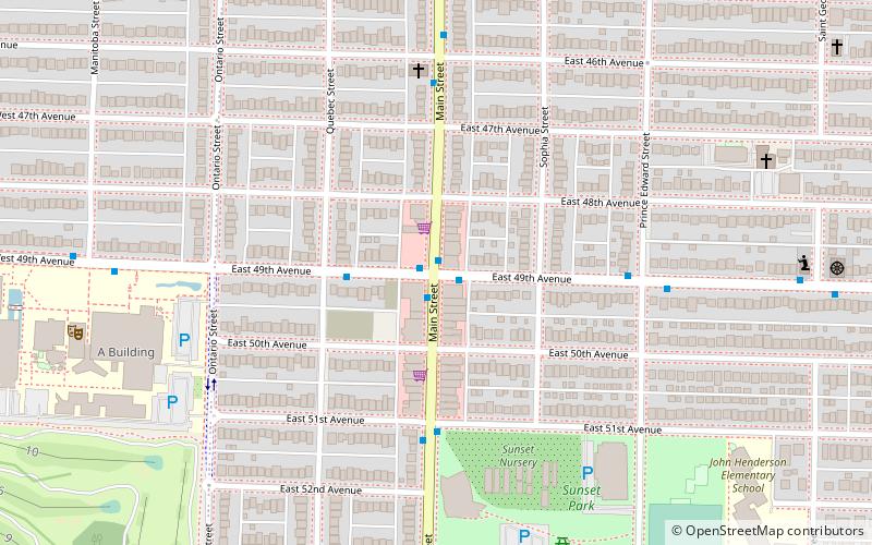
Map
Facts and practical information
Unitarian Church of Vancouver is the largest Unitarian congregation in British Columbia, Canada, and the oldest, established in 1909. ()
Coordinates: 49°13'37"N, 123°7'39"W
Address
949 West 49th AvenueOakridgeVancouver
Contact
+1 604-261-7204
Social media
Add
Getting there by public transportation
Public transportation stops near this location
- Metro
- Bus
- Trolleybus
 Metro
Metro
- Calculate routeWest 49th Avenue at Oak Street 2 min walk
- Calculate routeOak Street at West 49th Avenue 2 min walk
- Calculate routeOak St at West 54th Ave 10 min walk
- Calculate routeLangara-49th Avenue 13 min walk
- Calculate routeOakridge-41st Avenue 17 min walk
Maps SkyTrain
SkyTrainDay trips


Frequently Asked Questions (FAQ)
Which popular attractions are close to Unitarian Church of Vancouver?
Nearby attractions include Marpole-Oakridge Community Centre, Vancouver (18 min walk), South Granville Rise, Vancouver (21 min walk), VanDusen Botanical Garden, Vancouver (23 min walk).
How to get to Unitarian Church of Vancouver by public transport?
The nearest stations to Unitarian Church of Vancouver:
Bus
Trolleybus
Metro
Bus
- West 49th Avenue at Oak Street • Lines: 49 (2 min walk)
Trolleybus
- Oak Street at West 49th Avenue • Lines: 17 (2 min walk)
- Oak St at West 54th Ave • Lines: 17 (10 min walk)
Metro
- Langara-49th Avenue • Lines: Canada Line (13 min walk)
- Oakridge-41st Avenue • Lines: Canada Line (17 min walk)