Central McDougall, Edmonton
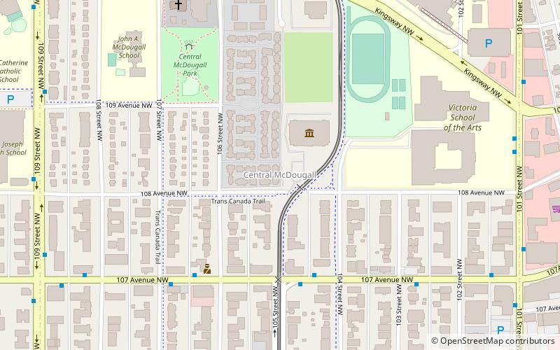
Map
Facts and practical information
Central McDougall is a largely residential neighbourhood in the City of Edmonton, Alberta, Canada located immediately north of the downtown core. ()
Area: 0.47 mi²Coordinates: 53°33'12"N, 113°30'4"W
Address
North Central Edmonton (Central McDougall)Edmonton
ContactAdd
Social media
Add
Getting there by public transportation
Public transportation stops near this location
- Bus
- Light rail
 Bus
Bus
- Calculate route101 Street & Kingsway 8 min walk
- Calculate routeKingsway/RAH Transit Centre 10 min walk
- Calculate route103 Street & 114 Ave 11 min walk
- Calculate routeKingsway & 111 Ave 11 min walk
- Calculate routeKingsway/Royal Alex 8 min walk
- Calculate routeMacEwan 11 min walk
- Calculate routeChurchill 21 min walk
- Calculate routeBay/Enterprise Square 22 min walk
Day trips


Frequently Asked Questions (FAQ)
Which popular attractions are close to Central McDougall?
Nearby attractions include Telephone Historical Centre, Edmonton (1 min walk), Ukrainian Museum of Canada, Edmonton (7 min walk), St. John Cathedral, Edmonton (8 min walk), St. Josaphat Cathedral, Edmonton (12 min walk).
How to get to Central McDougall by public transport?
The nearest stations to Central McDougall:
Bus
Light rail
Bus
- 101 Street & Kingsway • Lines: 560 (8 min walk)
- Kingsway/RAH Transit Centre • Lines: 202, 3, 560, Ebus (10 min walk)
Light rail
- Kingsway/Royal Alex • Lines: 502 (8 min walk)
- MacEwan • Lines: 502 (11 min walk)