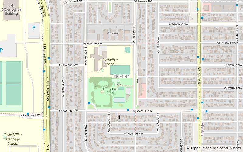
Parkallen, Edmonton
Map
Facts and practical information
Parkallen is a residential neighbourhood in south Edmonton, Alberta, Canada located just to the east of the University of Alberta farm and the Neil Crawford Centre. Most of the neighbourhood development occurred after the end of World War II with eight out of ten residences constructed by 1960 according to the 2005 municipal census. ()
Area: 210.04 acres (0.3282 mi²)Coordinates: 53°30'12"N, 113°31'3"W
Address
Southwest Edmonton (Parkallen)Edmonton
ContactAdd
Social media
Add
Getting there by public transportation
Public transportation stops near this location
- Bus
- Light rail
 Bus
Bus
- Calculate route113 Street & 67 Ave 6 min walk
- Calculate route65 Ave & 113 Street 8 min walk
- Calculate routeSouth Campus/Fort Edmonton Park 12 min walk
- Calculate routeMcKernan/Belgravia 20 min walk
- Calculate routeHealth Sciences/Jubilee 31 min walk
Day trips


Frequently Asked Questions (FAQ)
Which popular attractions are close to Parkallen?
Nearby attractions include Allendale, Edmonton (14 min walk), McKernan, Edmonton (17 min walk), Lendrum Place, Edmonton (19 min walk), Queen Alexandra, Edmonton (21 min walk).
How to get to Parkallen by public transport?
The nearest stations to Parkallen:
Bus
Light rail
Bus
- 113 Street & 67 Ave • Lines: 4 (6 min walk)
- 65 Ave & 113 Street • Lines: 4 (8 min walk)
Light rail
- South Campus/Fort Edmonton Park • Lines: 501, 502 (12 min walk)
- McKernan/Belgravia • Lines: 501, 502 (20 min walk)