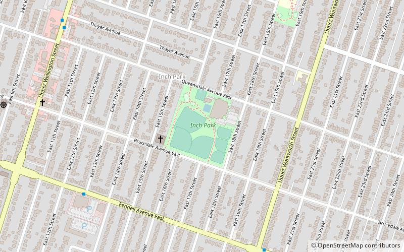
Inch Park, Hamilton
Map
Facts and practical information
Inch Park is a public park in the city of Hamilton, Ontario, Canada, located in the Mountain Inch neighborhood. The park opened in 1948, when the Inch family gave part of their family farm to the city for use as a park. ()
Elevation: 656 ft a.s.l.Coordinates: 43°14'11"N, 79°51'37"W
Address
Inch ParkHamilton
ContactAdd
Social media
Add
Getting there by public transportation
Public transportation stops near this location
- Bus
- Train
 Bus
Bus
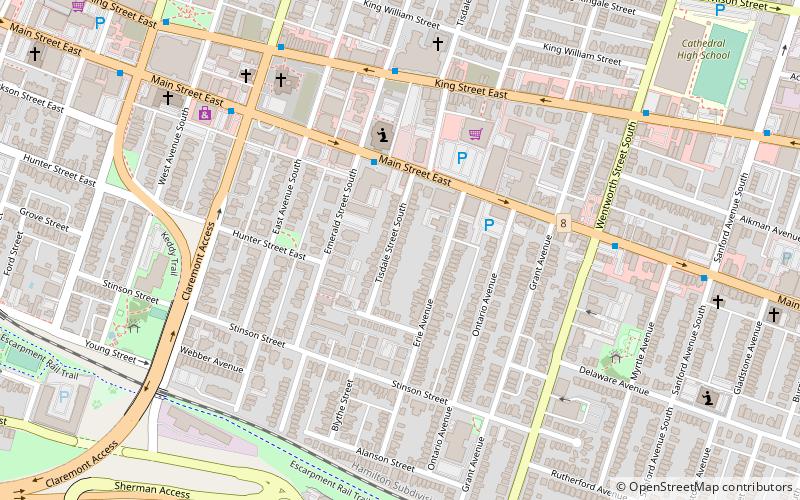
- Calculate routeMain at Wentworth 28 min walk
- Calculate routeKing at Wellington 31 min walk
- Calculate routeMohawk College Terminal Platform 3 31 min walk
- Calculate routeHamilton GO Centre 32 min walk
Day trips


Frequently Asked Questions (FAQ)
How to get to Inch Park by public transport?
The nearest stations to Inch Park:
Bus
Train
Bus
- Main at Wentworth • Lines: 10, 1A (28 min walk)
- King at Wellington • Lines: 10, 1A (31 min walk)
Train
- Hamilton GO Centre (32 min walk)