Queensway Terrace North, Ottawa
Map
Facts and practical information
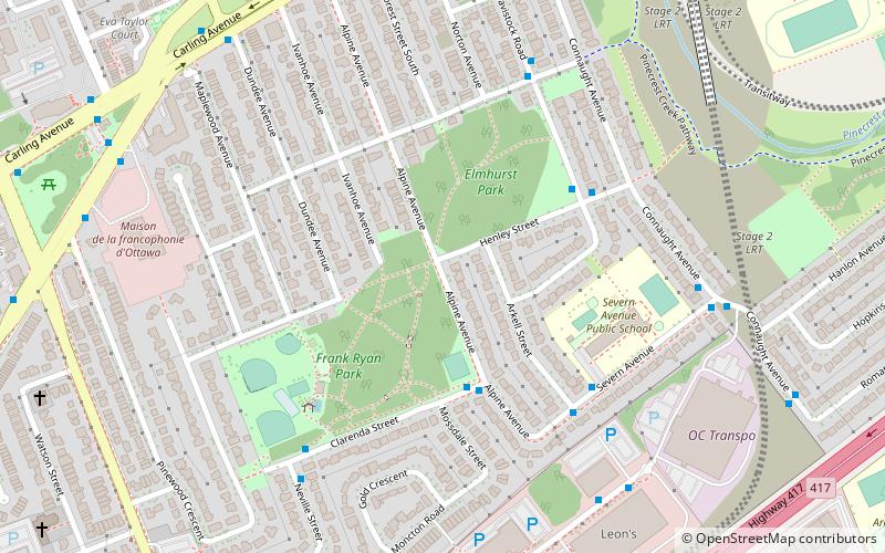
Queensway Terrace North is a neighbourhood in Bay Ward in the west end of Ottawa, Ontario, Canada. Its neighbourhood association is bounded to the north by Carling Avenue, to the west by Pinecrest Road, to the south by the Queensway, and to the east by the Transitway. These boundaries include the adjacent neighbourhood of Britannia Heights. ()
Coordinates: 45°21'29"N, 75°47'12"W
Address
Queensway Terrace NorthOttawa
ContactAdd
Social media
Add
Getting there by public transportation
Public transportation stops near this location
- Bus
 Bus
Bus
- Calculate routeClarenda / Alpine 3 min walk
- Calculate routeTavistock / Henley 4 min walk
- Calculate routeHenley / Tavistock 5 min walk
- Calculate routeSevern / Arkell 5 min walk
Day trips


Frequently Asked Questions (FAQ)
Which popular attractions are close to Queensway Terrace North?
Nearby attractions include Britannia Heights, Ottawa (9 min walk), Britannia United Church, Ottawa (10 min walk), St. Stephen's Anglican Church, Ottawa (12 min walk), Pinecrest Station, Ottawa (16 min walk).
How to get to Queensway Terrace North by public transport?
The nearest stations to Queensway Terrace North:
Bus
Bus
- Clarenda / Alpine • Lines: 155 (3 min walk)
- Tavistock / Henley • Lines: 154 (4 min walk)