Shaarei Tzedec, Toronto
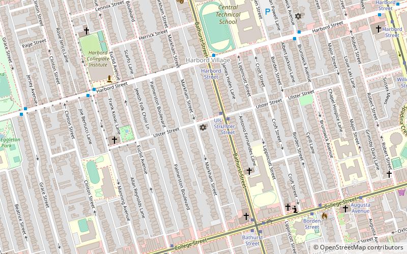
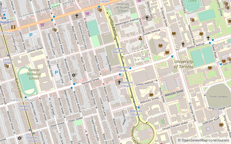
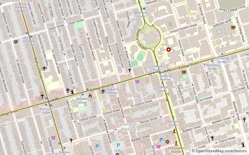
Map
Facts and practical information
Coordinates: 43°39'34"N, 79°24'36"W
Address
397 Markham StreetWest End (Palmerston)Toronto
Contact
+1 416-923-5828
Social media
Add
Getting there by public transportation
Public transportation stops near this location
- Metro
- Bus
- Tram
 Metro
Metro
- Calculate routeUlster Street 2 min walk
- Calculate routeHarbord Street 4 min walk
- Calculate routeCollege Street 7 min walk
- Calculate routeBathurst Street 7 min walk
- Calculate routeBathurst Street 4 min walk
- Calculate routeManning Avenue 7 min walk
- Calculate routeBathurst 12 min walk
- Calculate routeChristie 14 min walk
- Calculate routeSpadina 17 min walk
- Calculate routeSt. George 22 min walk
Maps SubwayMaps
 Streetcar systemMaps
 PATH
PATH
SubwayMapsStreetcar systemMapsPATHDay trips


Frequently Asked Questions (FAQ)
Which popular attractions are close to Shaarei Tzedec?
Nearby attractions include Harbord Village, Toronto (4 min walk), Church of St. Mary Magdalene, Toronto (5 min walk), Markham Street, Toronto (5 min walk), College Street United Church, Toronto (6 min walk).
How to get to Shaarei Tzedec by public transport?
The nearest stations to Shaarei Tzedec:
Tram
Bus
Metro
Tram
- Ulster Street • Lines: 511 (2 min walk)
- Harbord Street • Lines: 511 (4 min walk)
Bus
- Bathurst Street • Lines: 94A (4 min walk)
- Manning Avenue • Lines: 94A (7 min walk)
Metro
- Bathurst • Lines: 2 (12 min walk)
- Christie • Lines: 2 (14 min walk)