Ville-Émard, Montreal
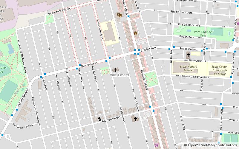
Map
Facts and practical information
Address
Le Sud-QuestMontreal
ContactAdd
Social media
Add
Getting there by public transportation
Public transportation stops near this location
- Metro
- Bus
 Metro
Metro
- Calculate routeJolicoeur / Hamilton 2 min walk
- Calculate routeMonk / Jolicoeur 3 min walk
- Calculate routeMonk 10 min walk
- Calculate routeJolicoeur 19 min walk
- Calculate routeAngrignon 19 min walk
Maps Metro
Metro
MetroDay trips


Frequently Asked Questions (FAQ)
Which popular attractions are close to Ville-Émard?
Nearby attractions include Le Sud-Ouest, Montreal (6 min walk), Côte-Saint-Paul, Montreal (13 min walk), Lachine Canal, Montreal (16 min walk), Saint-Henri, Montreal (22 min walk).
How to get to Ville-Émard by public transport?
The nearest stations to Ville-Émard:
Bus
Metro
Bus
- Jolicoeur / Hamilton • Lines: 37-N, 37-S (2 min walk)
- Monk / Jolicoeur • Lines: 36-E, 36-O (3 min walk)
Metro
- Monk • Lines: 1 (10 min walk)
- Jolicoeur • Lines: 1 (19 min walk)