Oxford Park, Montreal
Map
Facts and practical information
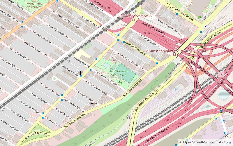
Oxford Park is a park in Montreal, Quebec, Canada. It is located in the southern part of the Notre-Dame-de-Grâce neighbourhood in the borough of Côte-des-Neiges–Notre-Dame-de-Grâce. While known informally as Oxford Park for many years, with activities operated by the Oxford Park Association, the City of Montreal formally named it the Georges-Saint-Pierre Park during the 1990s in honour of the founder of the local Caisse Populaire Saint-Raymond, a community credit union. ()
Elevation: 161 ft a.s.l.Coordinates: 45°28'7"N, 73°36'28"W
Address
Côte-des-Neiges-Notre-Dame-de-Gráce (Haut Lachine)Montreal
ContactAdd
Social media
Add
Getting there by public transportation
Public transportation stops near this location
- Metro
- Bus
- Train
 Metro
Metro
- Calculate routeUpper-Lachine / Oxford 3 min walk
- Calculate routeGirouard / Upper-Lachine 3 min walk
- Calculate routeUpper-Lachine / Harvard 4 min walk
- Calculate routeVendôme 11 min walk
- Calculate routeVendôme 11 min walk
- Calculate routeVilla-Maria 25 min walk
- Calculate routePlace Saint-Henri 31 min walk
Maps Metro
Metro
MetroDay trips


Frequently Asked Questions (FAQ)
Which popular attractions are close to Oxford Park?
Nearby attractions include Empress Theatre, Montreal (9 min walk), Turcot, Montreal (9 min walk), Saint-Henri, Montreal (9 min walk), Monument aux braves de N.D.G., Montreal (11 min walk).
How to get to Oxford Park by public transport?
The nearest stations to Oxford Park:
Bus
Train
Metro
Bus
- Upper-Lachine / Oxford • Lines: 104-E, 104-O, 90-E, 90-O (3 min walk)
- Girouard / Upper-Lachine • Lines: 17-S (3 min walk)
Train
- Vendôme (11 min walk)
Metro
- Vendôme • Lines: 2 (11 min walk)
- Villa-Maria • Lines: 2 (25 min walk)