Ma Wan Viaduct, Hong Kong

Gallery (2)
Map
Map
Gallery
Facts and practical information
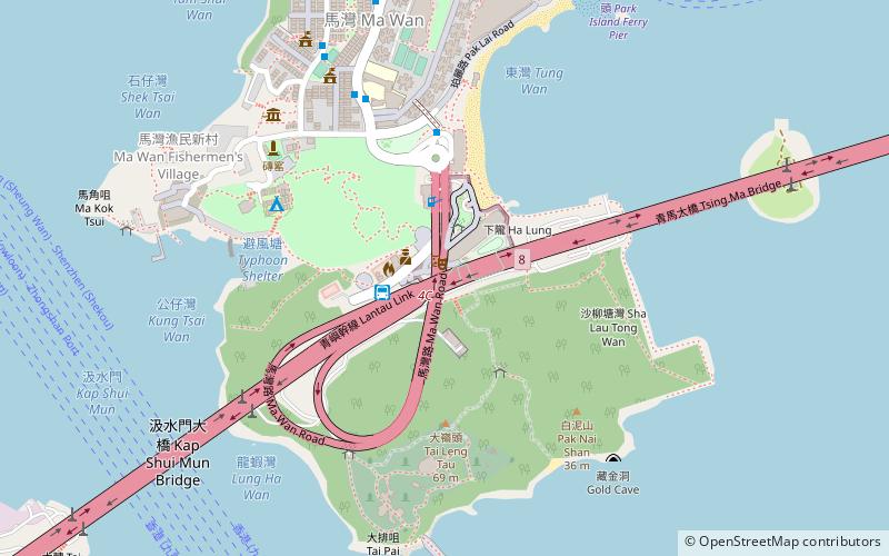
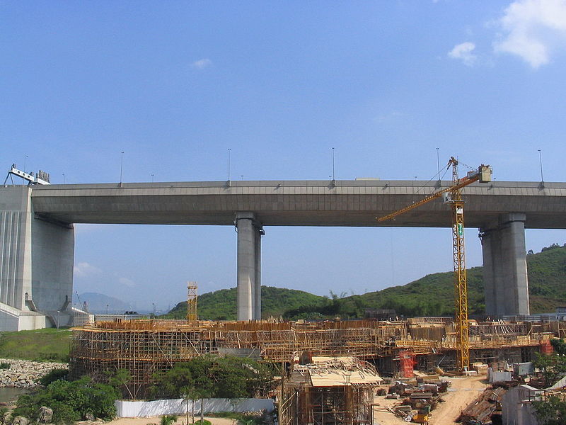
Ma Wan Viaduct is a viaduct built over Ma Wan, an island in Hong Kong. The viaduct connects the Tsing Ma Bridge and Kap Shui Mun Bridge with an exit to Ma Wan Road, and is part of the Lantau Link and Route 8. It was opened on 22 May 1997 and was built to provide access to the Hong Kong International Airport as part of the Airport Core Programme. ()
Address
荃湾区 (马湾)Hong Kong
ContactAdd
Social media
Add
Getting there by public transportation
Public transportation stops near this location
- Bus
- Ferry
 Bus
Bus
- Calculate routeMa Wan 2 min walk
- Calculate routePark Island 11 min walk
- Calculate routeSea Crest Villa Phase 3 31 min walk
- Calculate routeSea Crest Villa Phase 4 31 min walk
- Calculate routePark Island Pier 12 min walk
Maps MTRMaps
 LTRMaps
 Tram
Tram
MTRMapsLTRMapsTramDay trips


Frequently Asked Questions (FAQ)
Which popular attractions are close to Ma Wan Viaduct?
Nearby attractions include Noah's Ark, Hong Kong (3 min walk), Ma Wan, Hong Kong (3 min walk), Ma Wan Park, Hong Kong (4 min walk), Ma Wan Tung Wan Beach, Hong Kong (7 min walk).
How to get to Ma Wan Viaduct by public transport?
The nearest stations to Ma Wan Viaduct:
Bus
Ferry
Bus
- Ma Wan (2 min walk)
- Park Island (11 min walk)
Ferry
- Park Island Pier • Lines: Park Island - Central (12 min walk)