

Chiribiquete National Park Travel Guide
Facts and practical information
Nestled in the remote Caquetá region of Colombia, Chiribiquete National Park is a breathtaking and largely untouched natural wonder. Known for its stunning landscapes and rich biodiversity, Chiribiquete is a paradise for nature lovers and adventurers alike.
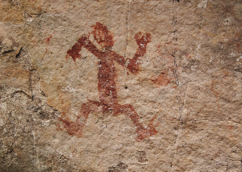
The park is home to the mesmerizing Chiribiquete plateau, a series of sandstone mesas that rise dramatically from the surrounding rainforest. These imposing formations are adorned with ancient rock art, some of which dates back over 20,000 years, offering a fascinating glimpse into the history of the region's indigenous peoples.
Visitors to Chiribiquete National Park can explore its diverse ecosystems, which range from lush rainforests to expansive savannas. The park is a haven for wildlife, with species such as jaguars, giant otters, and harpy eagles calling it home. Birdwatchers will be particularly enthralled by the park's avian inhabitants, which include over 300 species of birds.
For those seeking adventure, Chiribiquete offers ample opportunities for hiking, trekking, and wildlife spotting. The park's remote location and limited infrastructure make it a true off-the-beaten-path destination, allowing visitors to experience nature in its purest form.
In addition to its natural wonders, Chiribiquete National Park is also of great cultural significance. The rock art found within the park has been designated as a UNESCO World Heritage Site, and provides valuable insights into the traditions and beliefs of the indigenous peoples who once inhabited the area.
Caquetá
Chiribiquete National Park Attractions - What to See and Explore
Chiribiquete National Park offers many attractions and places to visit. Here are the most important ones: Serranía de Chiribiquete. Below you will find a complete list of places worth visiting.

Best Time To Visit Chiribiquete National Park
Learn when is the best time to travel to Chiribiquete National Park weather-wise and what to expect in each season.