Serranía de Chiribiquete, Chiribiquete National Park

Gallery (4)
Map

Map
Gallery
Facts and practical information
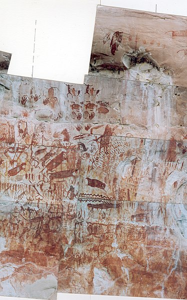
The Serranía de Chiribiquete or Chiribiquete Mountains are a group of isolated table mountains in the Amazon Region of Colombia. The mountains are part of the western edge of the Guiana Shield. The area is protected as a national park. This area is habitat for the Chiribiquete emerald, an endemic hummingbird. The waterfall Caño Paujil originates from the Serranía de Chiribiquete. ()
Local name: Sierra de Chiribiquete Area: 4942.1 mi²Maximum elevation: 98425 ftCoordinates: 1°19'39"N, 72°45'41"W
Address
Chiribiquete National Park
ContactAdd
Social media
Add