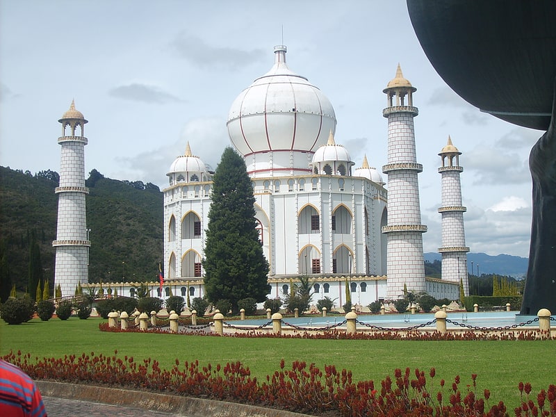
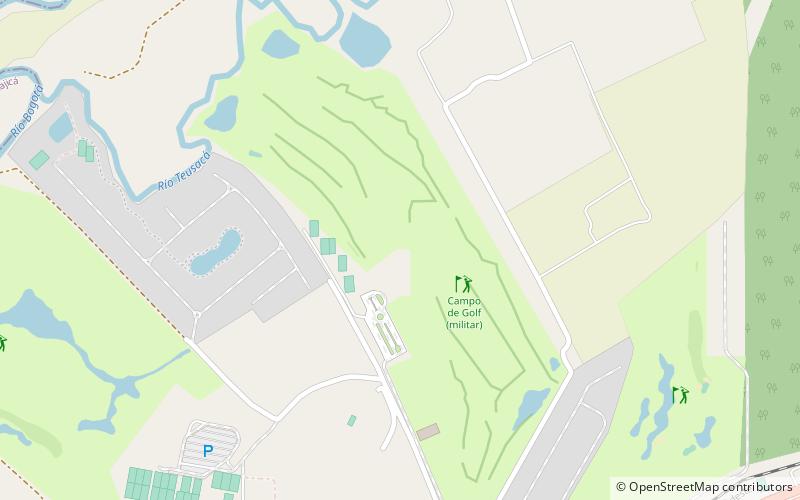
Trek Zone

Campo de Golf, Sopó

#1 among attractions in Sopó

Golf
Campo de Golf

Facts and practical information

Campo de Golf (address: Autopista Norte Km 30 Via Sopo - Entre Clubes) is a place located in Sopó (Cundinamarca department) and belongs to the category of golf.

It is situated at an altitude of 8402 feet, and its geographical coordinates are 4°56'27"N latitude and 73°59'42"W longitude.

Among other places and attractions worth visiting in the area are: Jaime Duque Park (amusement, 57 min walk), Cajicá (locality, 74 min walk), Tibitó, Zipaquirá (archaeological site, 82 min walk).

Coordinates: 4°56'27"N, 73°59'42"W
Address

Autopista Norte Km 30 Via Sopo - Entre ClubesSopó Colombia

ContactAdd
Social media
Add

Sopó plan & book

Unleash the traveler in you — discover the cheapest flight deals, find the perfect hotel or hostel nearby, and search for the best car rental prices. Travel at your own pace to discover new places and enjoy your journey.

Day trips

Campo de Golf – popular in the area (distance from the attraction)

Nearby attractions include: Jaime Duque Park, Salt Cathedral of Zipaquirá, Eastern Hills, Tibitó.

  • jaime duque park2.2 miE
  • salt cathedral of zipaquira5.5 miN
  • eastern hills6.1 miNE
  • tibito zipaquira location map
    3.2 miN
  • el abra6.1 miNE
  • parroquia divino salvador sopo4.4 miSE
  • cajica2.9 miSW
  • octavio arizmendi posada chia6.1 miSW
  • university of la sabana chia location map
    6 miSW
  • tocancipa5.7 miE

Where to next? Visit cundinamarca Cundinamarca region page or discover the top tourist attractions in Colombia.