Prague 18, Prague

Gallery (1)
Map
Map
Facts and practical information
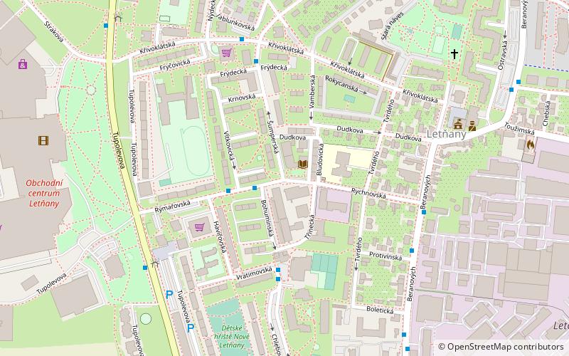
Prague 18 is a municipal district in Prague. It is located in the north-eastern part of the city. It is formed by one cadastre Letňany. As of 2008, there were 16,433 inhabitants living in Prague 18. ()
Coordinates: 50°8'10"N, 14°30'36"E
Getting there by public transportation
Public transportation stops near this location
- Metro
- Bus
- Train
 Metro
Metro
- Calculate routeŠumperská 2 min walk
- Calculate routeTřinecká 4 min walk
- Calculate routePoliklinika Frýdecká 5 min walk
- Calculate routeRychnovská 5 min walk
- Calculate routeLetňany 22 min walk
- Calculate routeStřížkov 29 min walk
- Calculate routePraha-Čakovice 25 min walk
Maps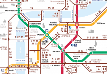 Metro / Trams
Metro / TramsDay trips


Frequently Asked Questions (FAQ)
How to get to Prague 18 by public transport?
The nearest stations to Prague 18:
Bus
Metro
Train
Bus
- Šumperská • Lines: 166 (2 min walk)
- Třinecká • Lines: 166 (4 min walk)
Metro
- Letňany • Lines: C (22 min walk)
- Střížkov • Lines: C (29 min walk)
Train
- Praha-Čakovice (25 min walk)