Esplanaden, Copenhagen

Gallery (2)
Map
Map
Gallery
Facts and practical information
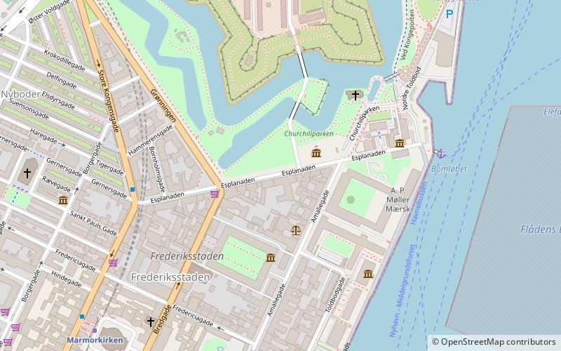
Esplanaden is a street in Copenhagen, Denmark. It extends eastwards from Store Kongensgade and runs along the south side of the city's 17th-century fortress Kastellet and Churchillparken until it reaches the waterfront at Nordre Toldbod, just south of Langelinie, passing Amaliegade, Bredgade and Grønningen on the way. It marks the northern border of the Frederiksstaden district. ()
Address
Indre By (Frederiksstaden)Copenhagen
ContactAdd
Social media
Add
Getting there by public transportation
Public transportation stops near this location
- Metro
- Bus
- Light rail
- Train
- Ferry
 Metro
Metro
- Calculate routeNordre Toldbod 5 min walk
- Calculate routeOperaen 12 min walk
- Calculate routeRefshaleøen 14 min walk
- Calculate routeHolmen Nord 14 min walk
- Calculate routeMarmorkirken 8 min walk
- Calculate routeØsterport 13 min walk
- Calculate routeKongens Nytorv 18 min walk
- Calculate routeGammel Strand 24 min walk
- Calculate routePapuga 10 min walk
- Calculate routeBorgergade 10 min walk
- Calculate routeOdd Fellow Palæet 11 min walk
- Calculate routeOperaen 11 min walk
- Calculate routeØsterport 12 min walk
- Calculate routeNørreport 23 min walk
- Calculate routeCopenhagen Central Station 40 min walk
- Calculate routeØsterport 12 min walk
- Calculate routeNørreport 25 min walk
- Calculate routeCopenhagen Central Station 41 min walk
Maps Metro
Metro
MetroDay trips


Frequently Asked Questions (FAQ)
Which popular attractions are close to Esplanaden?
Nearby attractions include Churchillparken, Copenhagen (2 min walk), Amaliegade 45, Copenhagen (2 min walk), Amaliegade 41, Copenhagen (2 min walk), Amaliegade 49, Copenhagen (2 min walk).
How to get to Esplanaden by public transport?
The nearest stations to Esplanaden:
Ferry
Metro
Bus
Train
Light rail
Ferry
- Nordre Toldbod • Lines: 991, 992 (5 min walk)
- Operaen • Lines: 991, 992 (12 min walk)
Metro
- Marmorkirken • Lines: M3, M4 (8 min walk)
- Østerport • Lines: M3, M4 (13 min walk)
Bus
- Papuga (10 min walk)
- Borgergade • Lines: 23 (10 min walk)
Train
- Østerport (12 min walk)
- Nørreport (23 min walk)
Light rail
- Østerport • Lines: A, B, Bx, C, E, H (12 min walk)
- Nørreport • Lines: A, B, Bx, C, E, H (25 min walk)