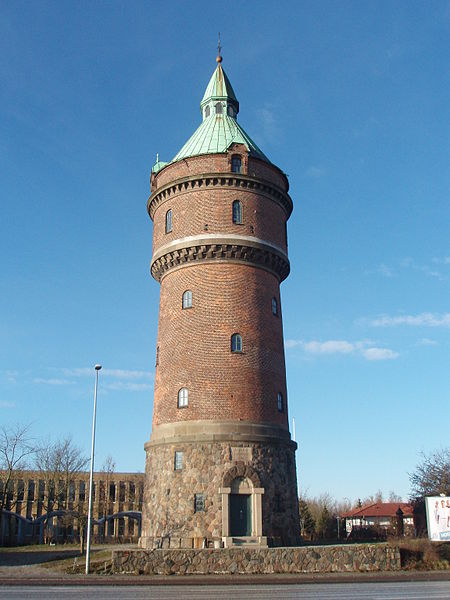
Aarhus N, Aarhus
Map

Gallery

Facts and practical information
Aarhus N is a postal district in the city of Aarhus, consisting of Trøjborg, Risskov, Vejlby, Skejby, Vorrevangen and Christiansbjerg, all with postal code 8200. Aarhus N is an abbreviation for Aarhus Nord and is located north of the city centre. It is the highest lying area of Aarhus. ()
Coordinates: 56°10'59"N, 10°12'14"E
Address
ChristiansbjergAarhus
ContactAdd
Social media
Add
Day trips
Aarhus N – popular in the area (distance from the attraction)
Nearby attractions include: Storcenter Nord, Naturhistorisk Museum, Riis Skov, INCUBA Science Park.
Frequently Asked Questions (FAQ)
Which popular attractions are close to Aarhus N?
Nearby attractions include Randersvej Water Tower, Aarhus (8 min walk), Christianskirken, Aarhus (13 min walk), Vejlby-Risskov Hallen, Aarhus (18 min walk), Antikmuseet, Aarhus (23 min walk).
How to get to Aarhus N by public transport?
The nearest stations to Aarhus N:
Bus
Tram
Light rail
Bus
- Vorregårds Allé/Vejlby Ringvej • Lines: 18 (3 min walk)
- Kongevellen • Lines: 18 (7 min walk)
Tram
- Vandtårnet • Lines: L2 (7 min walk)
- Stockholmsgade • Lines: L2 (9 min walk)
Light rail
- Vandtårnet • Lines: L2 (7 min walk)
- Stockholmsgade • Lines: L2 (9 min walk)


