Amaliegade, Copenhagen

Gallery (3)
Map
Map
Gallery
Facts and practical information
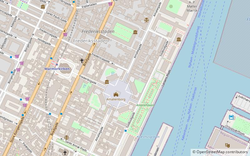
Amaliegade is a street in central Copenhagen, Denmark, which makes up the longer of the two axes on which the Rococo district Frederiksstaden is centred. Amaliegade extends from Sankt Annæ Plads to Esplanaden, passing through the central plaza of Amalienborg Palace on the way where it intersects Frederiksgade, the other, shorter but more prominent, axis of the district. ()
Getting there by public transportation
Public transportation stops near this location
- Metro
- Bus
- Light rail
- Train
- Ferry
 Metro
Metro
- Calculate routeMarmorkirken 5 min walk
- Calculate routeKongens Nytorv 12 min walk
- Calculate routeØsterport 17 min walk
- Calculate routeGammel Strand 20 min walk
- Calculate routeOdd Fellow Palæet 6 min walk
- Calculate routeSankt Annæ Plads, Skuespilhuset 7 min walk
- Calculate routeStore Kongensgade 8 min walk
- Calculate routeDronningens Tværgade 8 min walk
- Calculate routeOperaen 8 min walk
- Calculate routeNordre Toldbod 9 min walk
- Calculate routeNyhavn 10 min walk
- Calculate routeHolmen Nord 13 min walk
- Calculate routeØsterport 16 min walk
- Calculate routeNørreport 22 min walk
- Calculate routeCopenhagen Central Station 37 min walk
- Calculate routeØsterport 16 min walk
- Calculate routeNørreport 21 min walk
- Calculate routeCopenhagen Central Station 36 min walk
Maps Metro
Metro
MetroDay trips


Frequently Asked Questions (FAQ)
Which popular attractions are close to Amaliegade?
Nearby attractions include Niels Aagesen House, Copenhagen (1 min walk), Brockdorff's Palace, Copenhagen (1 min walk), Moltke's Palace, Copenhagen (1 min walk), Equestrian statue of Frederick V, Copenhagen (2 min walk).
How to get to Amaliegade by public transport?
The nearest stations to Amaliegade:
Metro
Bus
Ferry
Light rail
Train
Metro
- Marmorkirken • Lines: M3, M4 (5 min walk)
- Kongens Nytorv • Lines: M1, M2, M3, M4 (12 min walk)
Bus
- Odd Fellow Palæet • Lines: 23 (6 min walk)
- Sankt Annæ Plads, Skuespilhuset • Lines: 26 (7 min walk)
Ferry
- Operaen • Lines: 991, 992 (8 min walk)
- Nordre Toldbod • Lines: 991, 992 (9 min walk)
Light rail
- Østerport • Lines: A, B, Bx, C, E, H (16 min walk)
- Nørreport • Lines: A, B, Bx, C, E, H (22 min walk)
Train
- Østerport (16 min walk)
- Nørreport (21 min walk)