Banegårdsplads, Aarhus

Gallery (1)
Map
Map
Facts and practical information
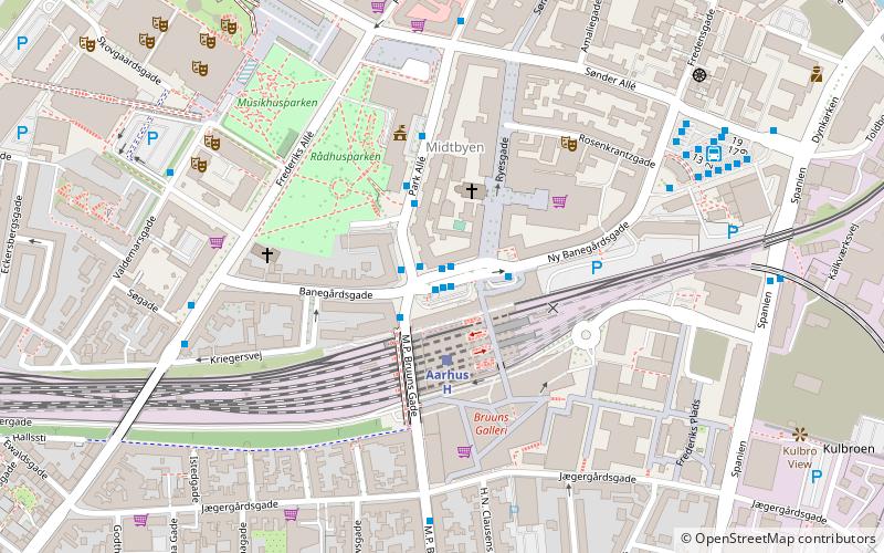
Banegårdsplads is a public square in Aarhus, Denmark, situated in the Indre By neighborhood. Banegårdsplads is where arrivals from the Aarhus Central Station enters the city and it functions as a central junction for the streets Banegårdsgade, Ny Banegårdsgade, M.P. Bruuns Gade, Park Allé and Ryesgade. ()
Local name: BanegårdspladsenLength: 394 ftCoordinates: 56°9'2"N, 10°12'14"E
Address
Århus CAarhus
ContactAdd
Social media
Add
Getting there by public transportation
Public transportation stops near this location
- Bus
- Tram
- Light rail
- Train
 Bus
Bus
- Calculate routeAarhus - Banegårdspladsen 1 min walk
- Calculate routePark Allé / Banegårdspladsen 1 min walk
- Calculate routePark Allé / Rådhuset 2 min walk
- Calculate routePark allé 3 min walk
- Calculate routeAarhus H 1 min walk
- Calculate routeNørreport 21 min walk
- Calculate routeKongsvang 40 min walk
- Calculate routeAarhus Central Station 2 min walk
- Calculate routeSkolebakken 15 min walk
- Calculate routeØstbanetorvet 25 min walk
- Calculate routeDokk1 11 min walk
- Calculate routeSkolebakken 15 min walk
- Calculate routeNørreport 21 min walk
- Calculate routeØstbanetorvet 25 min walk
Day trips


Frequently Asked Questions (FAQ)
Which popular attractions are close to Banegårdsplads?
Nearby attractions include Catholic Church of Our Lady, Aarhus (2 min walk), Park Allé, Aarhus (3 min walk), City Hall Park, Aarhus (3 min walk), Aarhus City Hall, Aarhus (4 min walk).
How to get to Banegårdsplads by public transport?
The nearest stations to Banegårdsplads:
Bus
Light rail
Train
Tram
Bus
- Aarhus - Banegårdspladsen • Lines: 100, 200, 3A (1 min walk)
- Park Allé / Banegårdspladsen • Lines: 11, 1A, 2A, 3A (1 min walk)
Light rail
- Aarhus H • Lines: L2 (1 min walk)
- Nørreport • Lines: L2 (21 min walk)
Train
- Aarhus Central Station (2 min walk)
- Skolebakken (15 min walk)
Tram
- Dokk1 • Lines: L2 (11 min walk)
- Skolebakken • Lines: L2 (15 min walk)