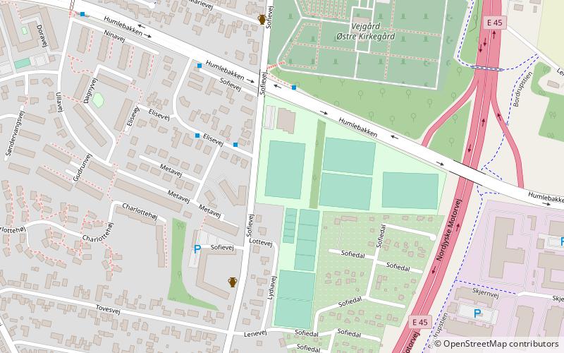
Soffy Road, Aalborg
Map
Facts and practical information
Soffy Road is an association football stadium in Vejgaard, Aalborg, Denmark. It is the home stadium of Denmark Series club Vejgaard BK. Information on stadium capacity is not available, but the attendance record is 1,005 which happened in the third round Danish Cup matchup against Danish Superliga club FC Nordsjælland on 27 September 2017. ()
Coordinates: 57°1'51"N, 9°57'60"E
Address
Aalborg
ContactAdd
Social media
Add
Getting there by public transportation
Public transportation stops near this location
- Bus
 Bus
Bus
- Calculate routeAAU Kantinen 29 min walk
- Calculate routeAAU Busterminal 36 min walk
Day trips


Frequently Asked Questions (FAQ)
Which popular attractions are close to Soffy Road?
Nearby attractions include Circle K Hadsundvej Aalborg Ø, Aalborg (15 min walk), Nørre Tranders Kirke, Aalborg (16 min walk).
How to get to Soffy Road by public transport?
The nearest stations to Soffy Road:
Bus
Bus
- AAU Kantinen • Lines: 2 (29 min walk)
- AAU Busterminal (36 min walk)