Sofiegade, Copenhagen
Map
Facts and practical information
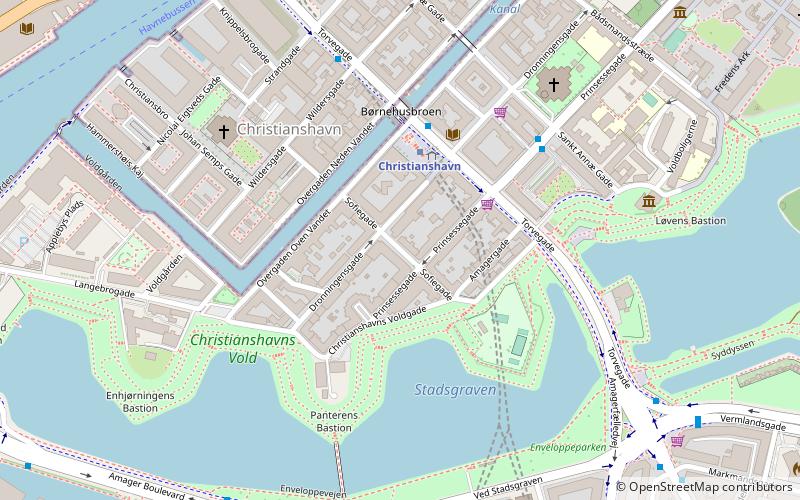
Sofiegade is a street in the Christianshavn neighbourhood of central Copenhagen, Denmark. It runs from Christianshavns Kanal in the northwest to Christianshavns Voldgade and Christianshavns Vold in the southeast, passing Dronningensgade and Prinsessegade on the way. ()
Coordinates: 55°40'15"N, 12°35'27"E
Address
ChristianshavnCopenhagen
ContactAdd
Social media
Add
Getting there by public transportation
Public transportation stops near this location
- Metro
- Bus
- Light rail
- Train
- Ferry
 Metro
Metro
- Calculate routeChristianshavn 3 min walk
- Calculate routeIslands Brygge 15 min walk
- Calculate routeKongens Nytorv 17 min walk
- Calculate routeGammel Strand 17 min walk
- Calculate routeChristianshavn St. 3 min walk
- Calculate routeSkt. Annæ Gade 4 min walk
- Calculate routeKnippelsbro 6 min walk
- Calculate routeØrestads Boulevard 7 min walk
- Calculate routeKnippelsbro 7 min walk
- Calculate routeDet Kongelige Bibliotek 11 min walk
- Calculate routeNyhavn 15 min walk
- Calculate routeOperaen 21 min walk
- Calculate routeCopenhagen Central Station 26 min walk
- Calculate routeNørreport 30 min walk
- Calculate routeCopenhagen Central Station 27 min walk
- Calculate routeNørreport 30 min walk
- Calculate routeVesterport 30 min walk
Maps Metro
Metro
MetroDay trips


Frequently Asked Questions (FAQ)
Which popular attractions are close to Sofiegade?
Nearby attractions include Steinfass House, Copenhagen (2 min walk), Dronningensgade, Copenhagen (2 min walk), Brøste House, Copenhagen (3 min walk), Heering House, Copenhagen (3 min walk).
How to get to Sofiegade by public transport?
The nearest stations to Sofiegade:
Metro
Bus
Ferry
Train
Light rail
Metro
- Christianshavn • Lines: M1, M2 (3 min walk)
- Islands Brygge • Lines: M1 (15 min walk)
Bus
- Christianshavn St. • Lines: 2A (3 min walk)
- Skt. Annæ Gade • Lines: 2A (4 min walk)
Ferry
- Knippelsbro • Lines: 991, 992 (7 min walk)
- Det Kongelige Bibliotek • Lines: 991, 992 (11 min walk)
Train
- Copenhagen Central Station (26 min walk)
- Nørreport (30 min walk)
Light rail
- Copenhagen Central Station • Lines: A, B, Bx, C, E, H (27 min walk)
- Nørreport • Lines: A, B, Bx, C, E, H (30 min walk)