University of Copenhagen, Copenhagen
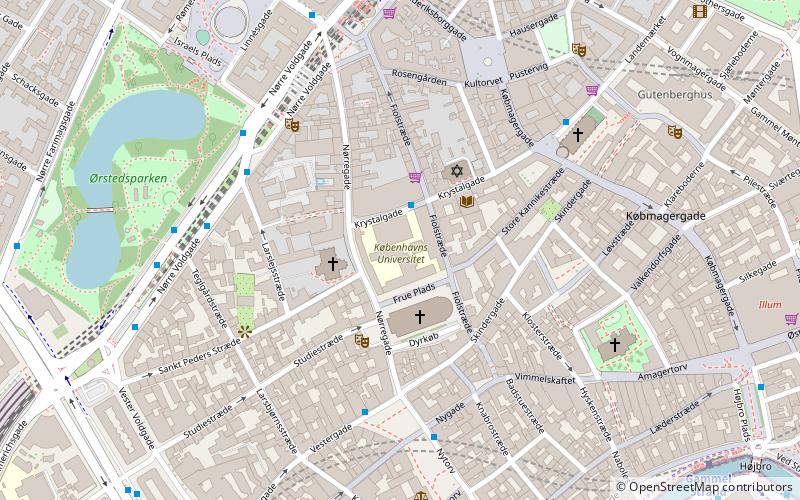
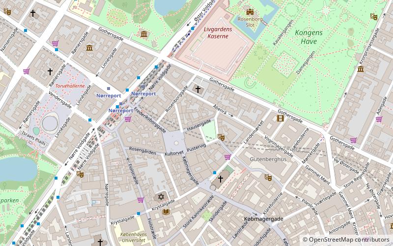
Map
Facts and practical information
The University of Copenhagen is a public research university in Copenhagen, Denmark. Founded in 1479, the University of Copenhagen is the second-oldest university in Scandinavia after Uppsala University, and ranks as one of the top universities in the Nordic countries and Europe. ()
Getting there by public transportation
Public transportation stops near this location
- Metro
- Bus
- Light rail
- Train
- Ferry
 Metro
Metro
- Calculate routeTeglgårdstræde 5 min walk
- Calculate routeNørreport St. 7 min walk
- Calculate routeRådhuspladsen St. 9 min walk
- Calculate routeNørreport 6 min walk
- Calculate routeVesterport 12 min walk
- Calculate routeCopenhagen Central Station 17 min walk
- Calculate routeØsterport 27 min walk
- Calculate routeNørreport 7 min walk
- Calculate routeCopenhagen Central Station 16 min walk
- Calculate routeØsterport 29 min walk
- Calculate routeNørreport 7 min walk
- Calculate routeRådhuspladsen 8 min walk
- Calculate routeGammel Strand 8 min walk
- Calculate routeKongens Nytorv 14 min walk
- Calculate routeDet Kongelige Bibliotek 17 min walk
- Calculate routeKnippelsbro 19 min walk
- Calculate routeNyhavn 22 min walk
- Calculate routeOperaen 27 min walk
Maps Metro
Metro
MetroDay trips
University of Copenhagen – popular in the area (distance from the attraction)
Nearby attractions include: Strøget, Købmagergade, Strædet, Church of Our Lady.


Frequently Asked Questions (FAQ)
Which popular attractions are close to University of Copenhagen?
Nearby attractions include Copenhagen University Library, Copenhagen (1 min walk), Frue Plads, Copenhagen (1 min walk), Krystalgade, Copenhagen (1 min walk), Latin Quarter, Copenhagen (2 min walk).
How to get to University of Copenhagen by public transport?
The nearest stations to University of Copenhagen:
Bus
Light rail
Train
Metro
Ferry
Bus
- Teglgårdstræde • Lines: 5C (5 min walk)
- Nørreport St. • Lines: 14, 150S, 15E, 184, 185, 350S, 5C, 6A (7 min walk)
Light rail
- Nørreport • Lines: A, B, Bx, C, E, H (6 min walk)
- Vesterport • Lines: A, B, Bx, C, E, H (12 min walk)
Train
- Nørreport (7 min walk)
- Copenhagen Central Station (16 min walk)
Metro
- Nørreport • Lines: M1, M2 (7 min walk)
- Rådhuspladsen • Lines: M3, M4 (8 min walk)
Ferry
- Det Kongelige Bibliotek • Lines: 991, 992 (17 min walk)
- Knippelsbro • Lines: 991, 992 (19 min walk)