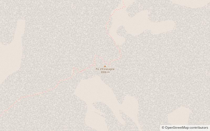
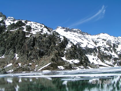
Estaragne, Pyrénées National Park
#13 among attractions in Pyrénées National Park

Facts and practical information
The Estaragne is a French pyrenean summit, culminating at 3,006 m m. ()
Pyrénées National Park France
Pyrénées National Park plan & book
Unleash the traveler in you — discover the cheapest flight deals, find the perfect hotel or hostel nearby, and search for the best car rental prices. Travel at your own pace to discover new places and enjoy your journey.
Estaragne – popular in the area (distance from the attraction)
Nearby attractions include: Pic de Néouvielle, Lac d'Aumar, Lac de l'Oule, Lac d'Orédon.
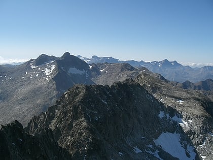
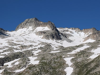 Soaring peak with granite and glaciers
Pic de Néouvielle, Néouvielle National Nature Reserve
71 min walk • Pic de Néouvielle is a mountain in the Néouvielle massif in the French Pyrenees. It is located in the commune of Saint-Lary-Soulan within the department of the Hautes-Pyrénées, and lies on the border between the Pyrenees National Park and the Néouvielle National Nature Reserve.
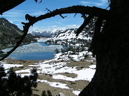 Nature, Natural attraction, Lake
Lac d'Aumar, Néouvielle National Nature Reserve
83 min walk • Lac d'Aumar is a lake in Hautes-Pyrénées, France. At an elevation of 2192 m, its surface area is 0.25 km².
 Nature, Natural attraction, Lake
Lac de l'Oule
110 min walk • Lac de l'Oule is a lake in Hautes-Pyrénées, France. At an elevation of 1819 m, its surface area is 58 ha.
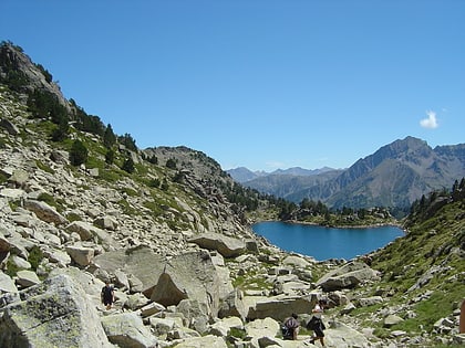
 Nature, Natural attraction, Lake
Lac d'Orédon, Aragnouet
65 min walk • Lac d'Orédon is a lake raised by a dam in Hautes-Pyrénées, France. At an elevation of 1849 m, its surface area is 0.46 km². It was one of the first lakes of the Pyrenees to have been built in the 17th century.
 Nature, Natural attraction, Mountain
Campbieil, Pyrénées National Park
16 min walk • The Campbieil is a summit in the French Pyrenees, culminating at a height of 3,173 m. It is located in the Néouvielle massif, included in the Pyrenees National Park of which it constitutes the second highest summit, after the pic Long.
 Nature, Natural attraction, Lake
Lac de Madamète
124 min walk • Lac de Madamète is a lake in Hautes-Pyrénées, France. At an elevation of 2299 m, its surface area is 0.026 km².
 Nature, Natural attraction, Lake
Lac d'Aubert, Néouvielle National Nature Reserve
82 min walk • Lac d'Aubert is a lake in Hautes-Pyrénées, France. At an elevation of 2148 m, its surface area is 0.45 km².
 Nature, Natural attraction, Mountain
Trois Conseillers, Pyrénées National Park
64 min walk • The Trois Conseillers is a summit in the French Pyrenees, culminating at 3,039 metres.
 Scenic mountain climbing destination
Pic Ramougn, Néouvielle National Nature Reserve
68 min walk • Pic Ramougn is a steep, rocky mountain in the Néouvielle massif in the Pyrenees. It is located in the commune of Saint-Lary-Soulan within the department of the Hautes-Pyrénées, and is named after the French politician, geologist and botanist Louis Ramond de Carbonnières.
 Nature, Natural attraction, Mountain
Turon de Néouvielle, Pyrénées National Park
62 min walk • The Turon du Néouvielle is a summit in the French Pyrenees, culminating at 3,035 m, located in the Néouvielle Range, on the edge of the Pyrenees National Park. It is famous for having the first recorded ascent of a Pyrenees peak over 3,000 metres.
 Nature, Natural attraction, Lake
Lac d'Arredoun
173 min walk • Lac d'Arredoun is a lake in Hautes-Pyrénées, France. At an elevation of 2,326 m, its surface area is 0.3 km2.


