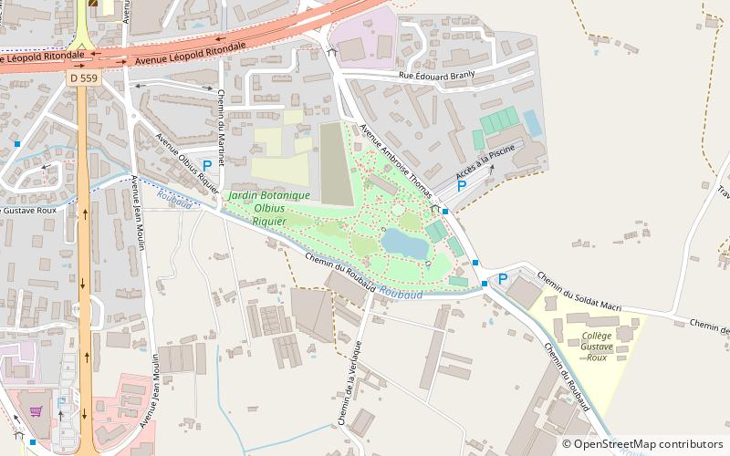
Parc Olbius Riquier, Hyères
Map
Facts and practical information
Parc Olbius Riquier is a municipal park located in the city of Hyères in the Var Department of France. It is classified by the French Ministry of Culture as one of the Remarkable Gardens of France. ()
Getting there by public transportation
Public transportation stops near this location
- Bus
 Bus
Bus
- Calculate routeOlbius Riquier 3 min walk
- Calculate routeGymnase Rougières 4 min walk
- Calculate routeBranly 6 min walk
- Calculate routeSimenon 10 min walk
Day trips


Frequently Asked Questions (FAQ)
Which popular attractions are close to Parc Olbius Riquier?
Nearby attractions include Médiathèque, Hyères (12 min walk), St. Louis Church, Hyères (21 min walk), Tour des Templiers, Hyères (22 min walk), Église Saint-Paul d'Hyères, Hyères (22 min walk).
How to get to Parc Olbius Riquier by public transport?
The nearest stations to Parc Olbius Riquier:
Bus
Bus
- Olbius Riquier • Lines: 63 (3 min walk)
- Gymnase Rougières • Lines: 63 (4 min walk)