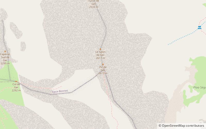
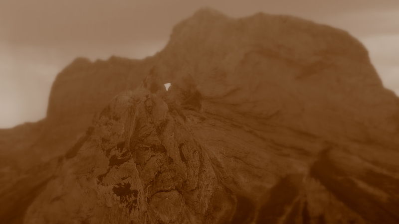
Pic de Ger
#974 among destinations in France
![Pic de Ger location map](https://tzmedia.b-cdn.net/media/images/static-maps/fr/42_9366_-0_35425.jpg)
![Pic de Ger](https://tzmedia.b-cdn.net/media/images/fr/place/gallery/medium/2305b5dede08f5571ce829455440a99e.jpg)
Facts and practical information
The Pic de Ger is a French Pyrenean summit, culminating at 2,613 m, located in the Ossau Valley in the Béarn province. ()
New AquitaineFrance
Pic de Ger plan & book
Unleash the traveler in you — discover the cheapest flight deals, find the perfect hotel or hostel nearby, and search for the best car rental prices. Travel at your own pace to discover new places and enjoy your journey.
Pic de Ger – popular in the area (distance from the attraction)
Nearby attractions include: Ossau Valley, Lac de Bious-Artigues, Lac d'Artouste, Lac de Suyen.
4.4 miNWNature, Natural attraction, ValleyOssau Valley, Laruns
114 min walk • The Ossau Valley is a valley of the French Pyrénées, in the Pyrénées-Atlantiques département.
7 miSWNatural attraction, Body of water, ParkLac de Bious-Artigues, Laruns
178 min walk • Lac de Bious-Artigues is a lake in Pyrénées-Atlantiques, Pyrénées, France. At an elevation of 1416 m, its surface area is 0.326 km².
5.5 miSNature, Natural attraction, LakeLac d'Artouste
141 min walk • Nestled in the heart of the Pyrenees mountains in France, Lac d'Artouste is a breathtakingly beautiful glacial lake that offers a serene escape into nature. Located at an altitude of approximately 2,000 meters, it is a jewel of the Ossau Valley, known for its...
6 miSENature, Natural attraction, LakeLac de Suyen, Pyrénées National Park
155 min walk • Lac de Suyen is a lake in Hautes-Pyrénées, France. At an elevation of 1536 m, its surface area is 0.02 km².
4.4 miSWNature, Natural attraction, LakeLac de Fabrèges
113 min walk • Nestled in the heart of the Pyrenees mountains in France, Lac de Fabrèges is a serene alpine lake that offers visitors a tranquil escape amidst stunning natural beauty. This picturesque body of water is a hidden gem known for its crystal-clear waters and the...
2.9 miNHigh-altitude alpine pass and cycle routeCol d'Aubisque, Béost
74 min walk • The Col d'Aubisque is a mountain pass in the Pyrenees 30 km south of Tarbes and Pau in the department of the Pyrénées-Atlantiques, in the Aquitaine region of France.
5.6 miSENature, Natural attraction, LakeLac de Batbielh, Pyrénées National Park
144 min walk • Lac de Batbielh is a very small lake in Hautes-Pyrénées, France, located approximately 2 km north of the French–Spanish border within the Pyrénées National Park. At an elevation of 2229 m, its surface area is 0.01 km².
4.5 miSENature, Natural attraction, LakeLac de Migouélou, Pyrénées National Park
114 min walk • Lac de Migouélou is a lake in Hautes-Pyrénées, France. At an elevation of 2278 m, its surface area is 0.48 km².
4.5 miSENature, Natural attraction, LakeLacs de Carnau, Pyrénées National Park
115 min walk • Lacs de Carnau is a group of lakes in Pyrénées-Atlantiques, France. At an elevation of 2,202 and 2,208 m, its surface area is 3 ha.
5.2 miSNature, Natural attraction, LakeLacs de Batboucou, Pyrénées National Park
132 min walk • Lacs de Batboucou is a group of lakes in Pyrénées-Atlantiques, France. At an elevation of 2,093 and 2,099 m, its surface area is 2 ha.
3.2 miNWLocalityEaux-Bonnes
82 min walk • Eaux-Bonnes is a commune in the Pyrénées-Atlantiques department in south-western France.