La Petite Rockette, Paris

Facts and practical information
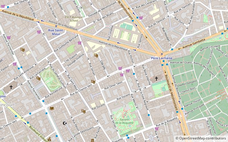
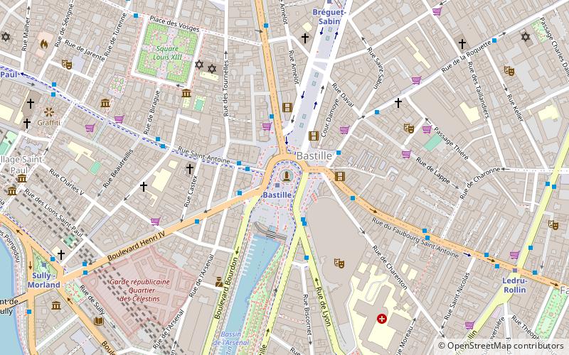
La Petite Rockette (address: 125 Rue Du Chemin Vert) is a place located in Paris (Île-de-France region) and belongs to the category of shopping, market, non-profit.
It is situated at an altitude of 187 feet, and its geographical coordinates are 48°51'44"N latitude and 2°23'2"E longitude.
Planning a visit to this place, one can easily and conveniently get there by public transportation. La Petite Rockette is a short distance from the following public transport stations: Folie Regnault - Chemin Vert (bus, 2 min walk), Père Lachaise (metro, 4 min walk), Nation (train, 29 min walk), Porte de Bagnolet (tram, 30 min walk), Jardin des Plantes (ferry, 37 min walk).
Among other places and attractions worth visiting in the area are: Musée du Fumeur (museum, 7 min walk), Musée Édith Piaf (museum, 8 min walk), 11th arrondissement of Paris (neighbourhood, 9 min walk).
- Metro
- Bus
- Tram
- Train
- Ferry
 Metro
Metro
- Calculate routeFolie Regnault - Chemin Vert 2 min walk
- Calculate routePère Lachaise 5 min walk
- Calculate routeMenilmontant - Nanettes 5 min walk
- Calculate routeAuguste Métivier 6 min walk
- Calculate routePère Lachaise 4 min walk
- Calculate routeRue Saint-Maur 7 min walk
- Calculate routeMénilmontant 9 min walk
- Calculate routeVoltaire 9 min walk
- Calculate routeNation 29 min walk
- Calculate routeEast Station 39 min walk
- Calculate routePorte de Bagnolet 30 min walk
- Calculate routeMarie de Miribel 31 min walk
- Calculate routeSéverine 31 min walk
- Calculate routeAdrienne Bolland 34 min walk
- Calculate routeJardin des Plantes 37 min walk
 Metro
Metro


Frequently Asked Questions (FAQ)
Which popular attractions are close to La Petite Rockette?
How to get to La Petite Rockette by public transport?
Bus
- Folie Regnault - Chemin Vert • Lines: 61, 69, N16, N34 (2 min walk)
- Père Lachaise • Lines: 61, 69, 71, N16, N34 (5 min walk)
Metro
- Père Lachaise • Lines: 2, 3 (4 min walk)
- Rue Saint-Maur • Lines: 3 (7 min walk)
Train
- Nation (29 min walk)
- East Station (39 min walk)
Tram
- Porte de Bagnolet • Lines: T3b (30 min walk)
- Marie de Miribel • Lines: T3b (31 min walk)
Ferry
- Jardin des Plantes • Lines: Batobus (37 min walk)