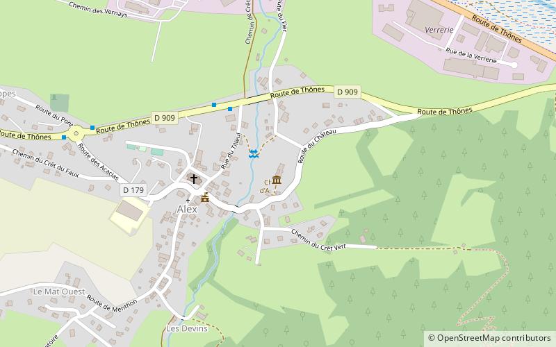
Château d'Arenthon, Alex
#2 among attractions in Alex
![Château d'Arenthon location map](https://tzmedia.b-cdn.net/media/images/static-maps/fr/45_8897_6_24046.jpg)
Facts and practical information
The castle of Alex is a former fortified house, of the XIVth century, center of the seigniory of Alex, erected in county in 1783, which stands on the commune of Alex in the department of Haute-Savoie, in the region Auvergne-Rhône-Alpes.
Alex France
Alex plan & book
Unleash the traveler in you — discover the cheapest flight deals, find the perfect hotel or hostel nearby, and search for the best car rental prices. Travel at your own pace to discover new places and enjoy your journey.
Château d'Arenthon – popular in the area (distance from the attraction)
Nearby attractions include: Lake Annecy, Château de Menthon-Saint-Bernard, La Tournette, Mont Veyrier.
3.8 miSWNature, Natural attraction, LakeLake Annecy
98 min walk • Nestled in the heart of the French Alps, Lake Annecy is a pristine natural wonder that has captivated visitors for centuries. Known for its crystal-clear waters, which are amongst the cleanest in the world, the lake is a hub for outdoor enthusiasts and those seeking a...
2.5 miSWForts and castlesChâteau de Menthon-Saint-Bernard, Menthon-Saint-Bernard
65 min walk • The Château de Menthon is a medieval castle located in the commune of Menthon-Saint-Bernard, 12 kilometres south of Annecy in the Haute-Savoie department of France. Standing on a 200 metres tall rock, its stone towers loom over Lake Annecy, the Roc de Chère National Nature Reserve, and Menthon-Saint-Bernard.
4.8 miSEDramatic peak with mountain and lake viewsLa Tournette, Annecy
124 min walk • The Tournette is a mountain in the Bornes Massif in Haute-Savoie, France. It is the highest of the mountains surrounding Lake Annecy and has a prominence of 1,514, qualifying it as an Ultra.
2.9 miWNature, Natural attraction, MountainMont Veyrier, Annecy
74 min walk • Mont Veyrier is a mountain located in the French Alps, in Haute Savoie. It culminates at 1,291 metres, and dominates the east side of Lake Annecy.
2 miSNature, Natural attraction, MountainDents de Lanfon
51 min walk • The Dents de Lanfon is a mountain in south-eastern France rising to 1824 m. Situated above Talloires on the east bank of Lac d'Annecy in Haute-Savoie. It is framed by mount Veyrier to the north, and by Le Lanfonnet and La Tournette to the south.
5 miNWAreaAnnecy-le-Vieux, Annecy
128 min walk • Annecy-le-Vieux is a former commune in the Haute-Savoie department in the Auvergne-Rhône-Alpes region in southeastern France. On 1 January 2017, it was merged into the commune Annecy.
4 miNNature, Natural attraction, MountainRefuge du Parmelan
103 min walk • Refuge du Parmelan is a refuge in the Alps.
4.4 miSForts and castlesChâteau d'Héré, Duingt
111 min walk • The castle of Héré is an old fortified house, from the end of the XIVth century, which stands on the commune of Duingt in the department of Haute-Savoie in the region Auvergne-Rhône-Alpes.
3.6 miSWOutdoor activitiesRoc de Chère National Nature Reserve, Talloires
92 min walk • The Roc de Chère National Nature Reserve is a major ecologic site in southeastern France. A protected nature reserve since 1977, it covers a small area of 69 hectares. It is located near the commune of Talloires, on the eastern bank of Lake Annecy at an elevation of 448 metres.
5.3 miWParkLe Pâquier, Annecy
135 min walk • The Pâquier or Champ de Mars is a vast landscaped promenade of seven and a half hectares in the commune of Annecy located on the shores of Lake Annecy and offering one of the most beautiful perspectives on the lake and the surrounding mountains.
5.3 miWBridgePont des Amours, Annecy
135 min walk • The Pont des Amours is a footbridge located on the edge of Lake Annecy at the entrance of the Canal du Vassé; its official name is "Passerelle du Jardin Public" but the inhabitants of Annecy have long since renamed it "Pont des Amours".