Stade Amable-et-Micheline-Lozai, Rouen
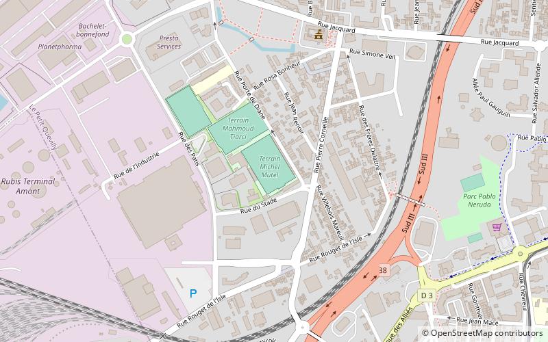
Map
Facts and practical information
The Stade Amable-et-Micheline-Lozai is a multi-purpose stadium located in Le Petit-Quevilly, France. It is home to US Quevilly-Rouen. ()
Address
Rouen
ContactAdd
Social media
Add
Getting there by public transportation
Public transportation stops near this location
- Bus
- Tram
 Bus
Bus
- Calculate routePlace du 8 Mai 11 min walk
- Calculate routeFrançois Truffaut 13 min walk
- Calculate routeSaint-Julien 16 min walk
- Calculate routeJean Jaurès 18 min walk
- Calculate routeLycée Élisa Lemonnier 18 min walk
- Calculate routeFoliot 18 min walk
- Calculate routeCharles de Gaulle 19 min walk
- Calculate routeChartreux 20 min walk
Day trips


Frequently Asked Questions (FAQ)
How to get to Stade Amable-et-Micheline-Lozai by public transport?
The nearest stations to Stade Amable-et-Micheline-Lozai:
Tram
Bus
Tram
- Place du 8 Mai • Lines: M (11 min walk)
- François Truffaut • Lines: M (13 min walk)
Bus
- Lycée Élisa Lemonnier • Lines: 6 (18 min walk)
- Foliot • Lines: 6 (18 min walk)