Peristeri, Athens
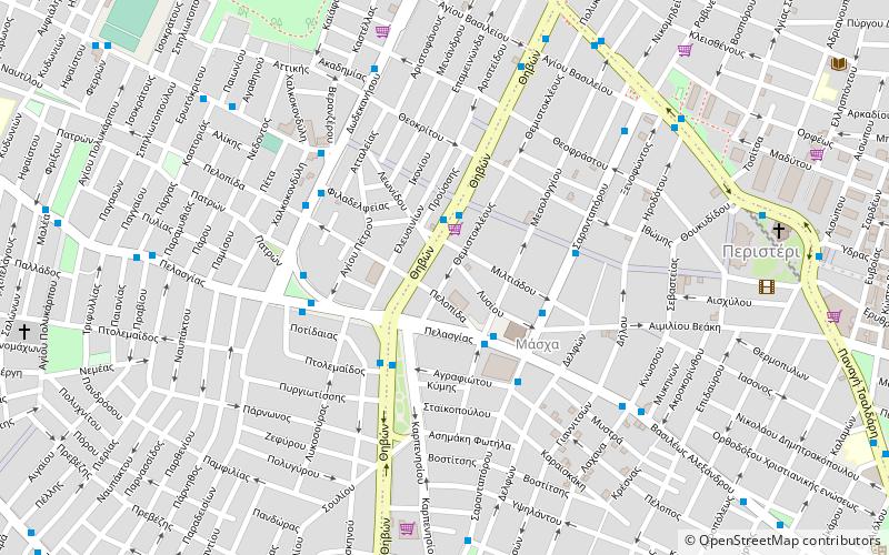
Map
Facts and practical information
Getting there by public transportation
Public transportation stops near this location
- Metro
- Bus
- Trolleybus
 Metro
Metro
- Calculate routeΕθνικησ Αντιστασεωσ 2 min walk
- Calculate routeΙκα 3 min walk
- Calculate routeΘηβών 8 min walk
- Calculate routeΤαχυδρομειο 8 min walk
- Calculate routeΜετρο Ανθουπολη 9 min walk
- Calculate routeΔημαρχειο 10 min walk
- Calculate routeAnthoupoli 9 min walk
- Calculate routePeristeri 9 min walk
- Calculate routeAgios Antonios 19 min walk
Day trips


Frequently Asked Questions (FAQ)
How to get to Peristeri by public transport?
The nearest stations to Peristeri:
Bus
Trolleybus
Metro
Bus
- Εθνικησ Αντιστασεωσ • Lines: 703, 731 (2 min walk)
- Ικα • Lines: 822, 823 (3 min walk)
Trolleybus
- Θηβών • Lines: 12, 24, 25 (8 min walk)
- Ταχυδρομειο • Lines: 12, 24, 25 (8 min walk)
Metro
- Anthoupoli • Lines: Μ2 (9 min walk)
- Peristeri • Lines: Μ2 (9 min walk)