Mint Street, Chennai
Map
Facts and practical information
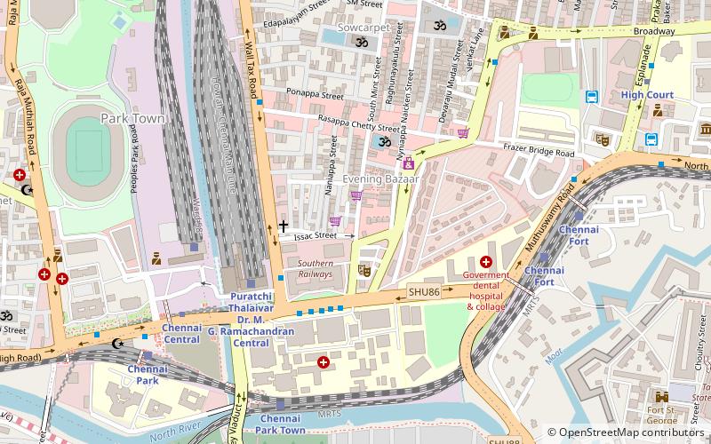
Mint Street is one of the prime streets of the commercial centre of George Town in Chennai, India. The street is one of the oldest streets in Chennai and is believed to be the longest street in the city. Running north–south, the street connects Poonamallee High Road at Park Town in the south with North Wall Road–Old Jail Road Junction at Washermanpet in the north. Running parallel to the Wall Tax Road, another historical thoroughfare in the city, the street passes through thickly populated residential and commercial areas of the historical neighbourhood. ()
Length: 8448 ftCoordinates: 13°5'2"N, 80°16'41"E
Address
Pulianthope (Edapalayam)Chennai
ContactAdd
Social media
Add
Getting there by public transportation
Public transportation stops near this location
- Metro
- Bus
- Light rail
- Train
 Metro
Metro
- Calculate routeGeneral Hospital 4 min walk
- Calculate routeCentral Station Bus Stop 6 min walk
- Calculate routeRipon Building 10 min walk
- Calculate routePuratchi Thalaivar Dr. M. G. Ramachandran Central 6 min walk
- Calculate routeChennai Fort 9 min walk
- Calculate routeM.G.R Chennai Central Suburban Terminal 10 min walk
- Calculate routeChennai Park 11 min walk
- Calculate routeCentral Metro 9 min walk
- Calculate routeHigh Court 14 min walk
- Calculate routeMannadi 25 min walk
- Calculate routeChennai Fort 9 min walk
- Calculate routeChintadaripet 20 min walk
Day trips


Frequently Asked Questions (FAQ)
Which popular attractions are close to Mint Street?
Nearby attractions include Ekambareswarar Temple, Chennai (8 min walk), Sowcarpet, Chennai (9 min walk), Victoria Public Hall, Chennai (10 min walk), Raja Annamalai Mandram, Chennai (11 min walk).
How to get to Mint Street by public transport?
The nearest stations to Mint Street:
Bus
Train
Metro
Light rail
Bus
- General Hospital • Lines: 5C (4 min walk)
- Central Station Bus Stop • Lines: 15B (6 min walk)
Train
- Puratchi Thalaivar Dr. M. G. Ramachandran Central (6 min walk)
- Chennai Fort (9 min walk)
Metro
- Central Metro • Lines: 1, 2 (9 min walk)
- High Court • Lines: 1 (14 min walk)
Light rail
- Chennai Fort • Lines: 1 (9 min walk)
- Chintadaripet • Lines: 1 (20 min walk)