Maratha Mandir, Mumbai
Facts and practical information
Maratha Mandir: An Iconic Cinema Hall in the Heart of Mumbai
Maratha Mandir is an iconic cinema hall located in the bustling city of Mumbai, India. Known for its rich history and cultural significance, this cinema has been a staple of Mumbai's entertainment landscape for decades. Situated in the heart of the city, Maratha Mandir has become synonymous with Bollywood nostalgia, particularly for its uninterrupted screening of the classic film "Dilwale Dulhania Le Jayenge" (DDLJ) since its release in 1995.
The cinema hall was established in the year 1958 and has since been a testament to the evolution of the Indian film industry. Maratha Mandir boasts a large auditorium with a seating capacity that accommodates a significant number of movie enthusiasts. Its grand facade and vintage charm continue to draw in crowds, offering a unique movie-watching experience that modern multiplexes often lack.
The tag 'cinema' barely scratches the surface when describing Maratha Mandir. It is not just a place to watch films; it is a cultural hub that has witnessed the growth of Bollywood and has been a part of countless memories for the residents of Mumbai. The cinema hall's commitment to showcasing DDLJ, a film that epitomizes romance in Indian cinema, has earned it a Guinness World Record for the longest-running film in a cinema hall.
The theater's interior harks back to an era of opulent movie palaces, with its plush seats and classic décor. While it has undergone renovations to keep up with modern technology, the essence of the old-world cinema experience is meticulously preserved. Patrons of Maratha Mandir often praise its well-maintained facilities and the quality of sound and projection, which enhance the viewing experience.
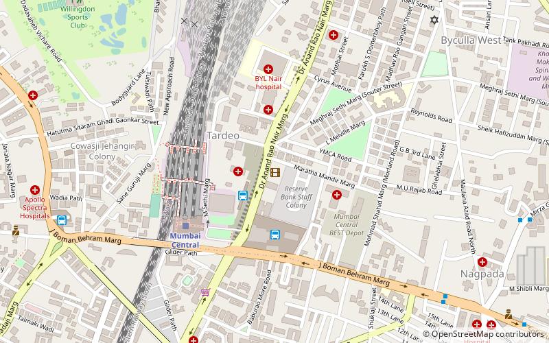
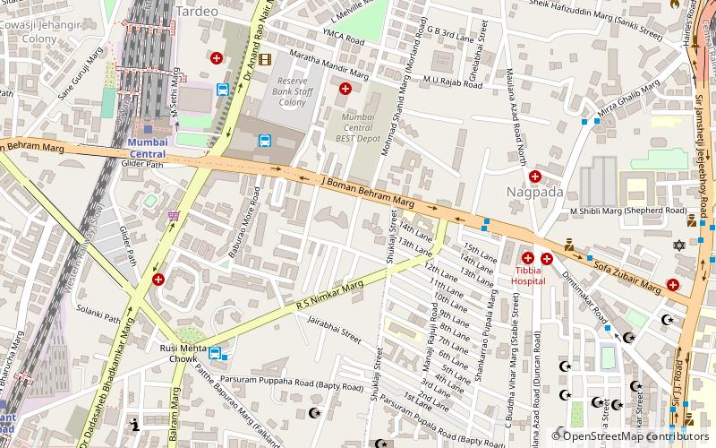
Maratha Mandir is easily accessible to both locals and tourists, situated near Mumbai Central Railway Station. It remains one of the city's most beloved landmarks, offering a nostalgic journey into the golden age of Hindi cinema. The cinema hall operates throughout the year, showcasing the latest Bollywood hits along with its permanent fixture, DDLJ.
Byculla - MazagaonMumbai
- Bus
- Train
 Bus
Bus
- Calculate routeBus Agencies 3 min walk
- Calculate routeMumbai Central Bus Station 4 min walk
- Calculate routeVasantrao Naik Chowk Tardeo Bus Station 12 min walk
- Calculate routeTardeo 12 min walk
- Calculate routeMumbai Central 6 min walk
- Calculate routeGrant Road 18 min walk
- Calculate routeByculla 21 min walk
- Calculate routeMahalaxmi 21 min walk


Frequently Asked Questions (FAQ)
Which popular attractions are close to Maratha Mandir?
How to get to Maratha Mandir by public transport?
Bus
- Bus Agencies (3 min walk)
- Mumbai Central Bus Station (4 min walk)
Train
- Mumbai Central (6 min walk)
- Grant Road (18 min walk)