Veterinary College, Bangalore
Map
Facts and practical information
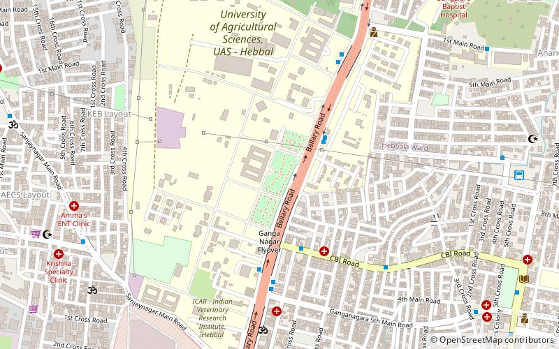
The Veterinary College, Bangalore was established on 25 July 1958 affiliated with Mysore University. The college started in a temporary shed located in the then Mysore Serum Institute, now called the Institute of Animal Health and Veterinary Biologicals, Hebbal. The Veterinary College became a constituent college of the University of Agricultural Sciences in 1965. ()
Elevation: 3028 ft a.s.l.Coordinates: 13°1'45"N, 77°35'9"E
Getting there by public transportation
Public transportation stops near this location
- Bus
- Train
 Bus
Bus
- Calculate routeCBI Office 5 min walk
- Calculate routeCbi 6 min walk
- Calculate routeVeterinary College 7 min walk
- Calculate routeVasanthappa Block 8 min walk
- Calculate routeHebbal 24 min walk
Day trips


Frequently Asked Questions (FAQ)
Which popular attractions are close to Veterinary College?
Nearby attractions include Sanjaynagar, Bangalore (16 min walk), Hebbal, Bangalore (20 min walk), GUHPS Hebbal, Bangalore (22 min walk), Sri Ananda Lingeshwara Temple, Bangalore (23 min walk).
How to get to Veterinary College by public transport?
The nearest stations to Veterinary College:
Bus
Train
Bus
- CBI Office • Lines: 108, 176 (5 min walk)
- Cbi • Lines: 286A (6 min walk)
Train
- Hebbal (24 min walk)